
Day 1: Canoe to McIntosh
Ice-out took its sweet time in 2014. While not record setting, it was only 8 days shy of the May 15th benchmark. Ice-out was declared as May 7th, 2014 for Opeongo. In mid-April, whether psychic or lucky I'd booked a trip to begin on May 10th, and so I stuck to that reservation. The problem with booking early, of course, is the wait.
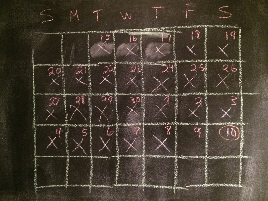
Kitchen wall chalkboard, counting down the days until the first trip of 2014
Fortunately the wait was over, and it was time to get a move-on!
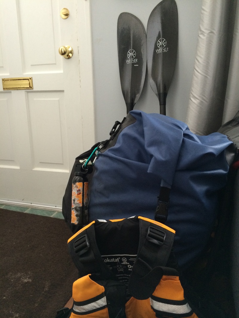
Gear piled up near the door the night before
By 6 AM I was on the road, and despite a detour on Hwy 400 due to a traffic accident, I still made good time. The Canoe Lake access point and my destination for the evening, McIntosh Lake, are both well-travelled routes for me. While I hadn't camped on McIntosh more than once or twice before, many trips had taken me through it. But I decided it was a perfect stop for the first night, the logic being: It's a beautiful lake, and it's the other side of 2400m portage, enough to dissuade many campers.
Paddling Canoe, the Western Gap, Tepee Lake (waving hello to the empty Camp Arowhon), Little Oxtongue, skirting Littledoe into Tom Thomson, it's a route anyone who's spent time in Algonquin has experienced. But as this was my first trip of the year, even well-travelled waters were exciting, and every paddle stroke felt light and easy. As I crossed Tom Thomson and rounded the final bend where the portage into Ink came into sight, I was almost looking forward to the first real portage of the camping season.
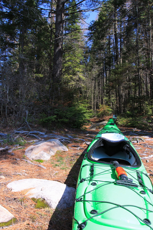
For those who don't know it, the 2390m from Tom Thomson into Ink has a little bit of everything. While it has no serious elevation changes, it has a lot of rough footing with rocks and tree roots in abundance, dips and climbs, wood walkways over wet lowlands, and plenty of ups and downs to sap the will. To me, it always feels longer than it really is. A side effect of taking this portage so soon into camping season became obvious quickly: no-one had come through yet this year to clear it. Some deadfalls were just step-overs, but there were a few occasions when it required serious work to navigate around or through. While a person walking through the woods can easily step around a fallen tree, it's another story with a 16 foot boat on your shoulders.
The end of the portage into Ink is a steep descent down to the waterline. While steps have helpfully been laid, they're built for legs longer than most mortal human beings, in that awkward 'step and a half' range where it's neither comfortable to try to take them one by one, or take two steps for each. It was one last navigation challenge before finally setting down the kayak, but at least it was downhill. The bottom had almost nothing by way of a landing so I found myself parking the kayak at an awkward uphill angle while loading it up.
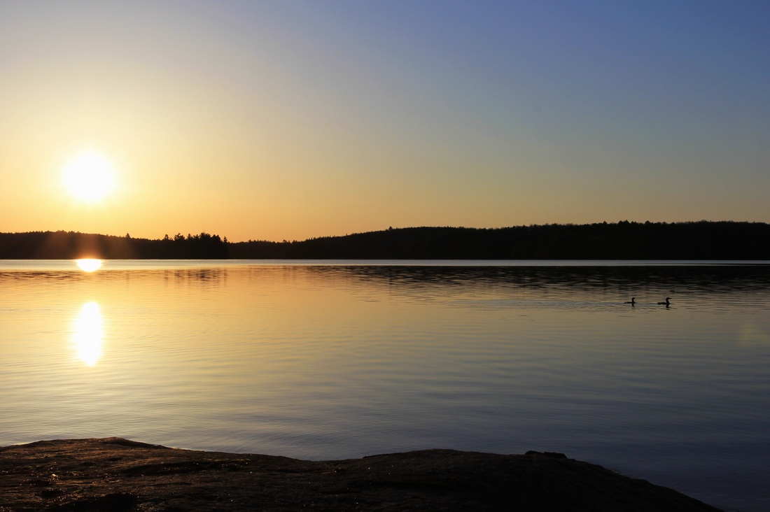
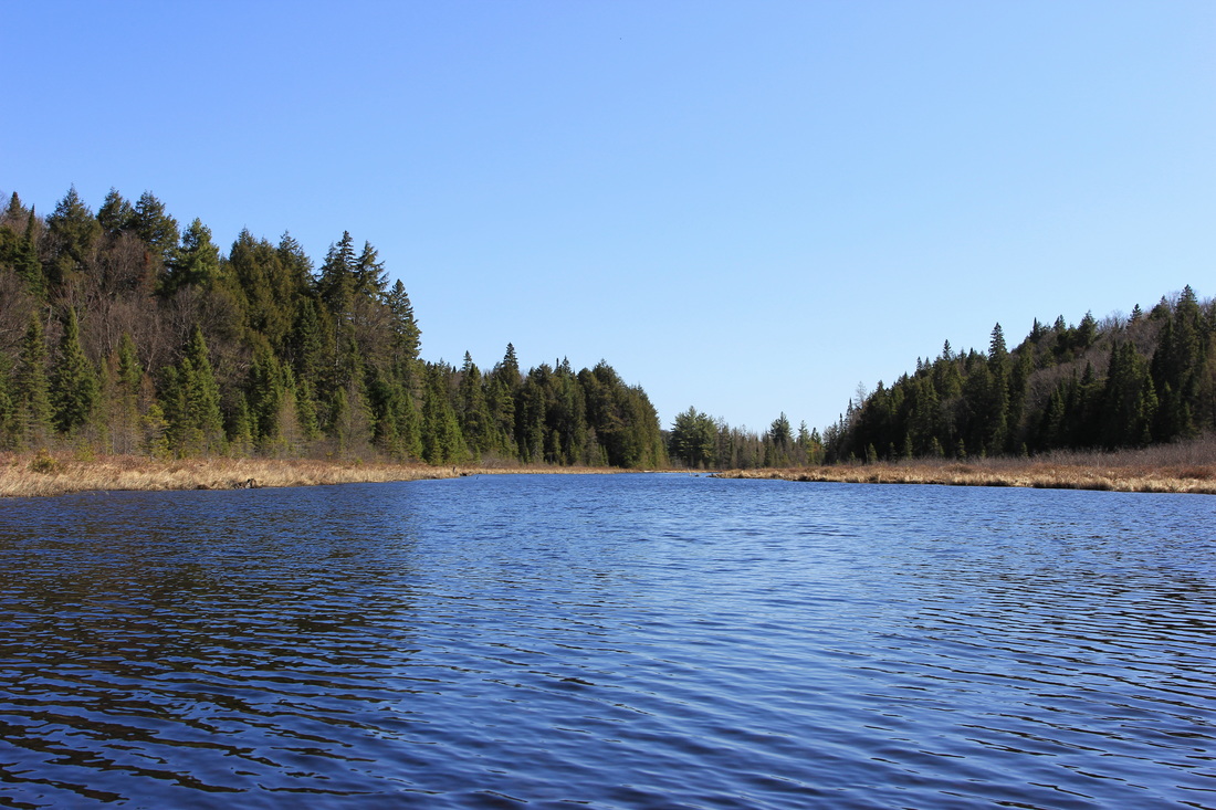
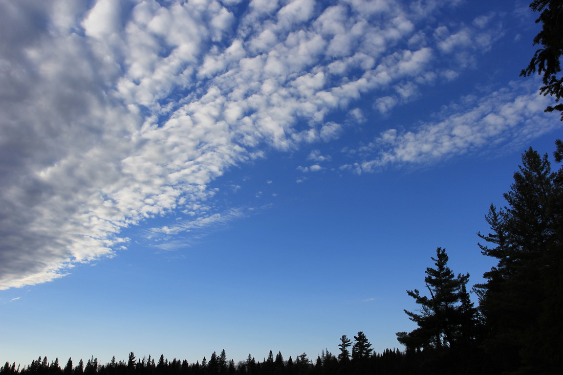
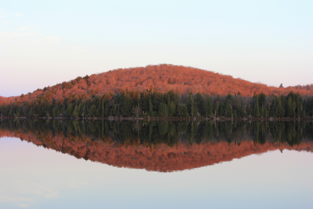
Ink Lake lives up to its name: dark, stained waters. The entrance to to the creek leading from Ink to McIntosh wasn't apparent until I was almost upon it, but soon enough I was winding through it. McIntosh opened before me not long after, and choosing a campsite was the only remaining task of my travel day. While I prefer westward facing sites, the portage into Timberwolf (my first of the next day) was on the NorthWest side of McIntosh, and so I stayed along the west side of the lake, looking for a campsite worth stopping for. This early in the season, finding good camping sites isn't a question of "If", only a question of "When", and well before the Timberwolf portage I stopped on a beautiful Canadian Shield campsite. Excited to be on my first site of the year, it was hours before I thought to take any pictures. After dinner, and not long before I bed, I took a single photo with my phone - the camera didn't make an appearance until the following morning.
Paddling Canoe, the Western Gap, Tepee Lake (waving hello to the empty Camp Arowhon), Little Oxtongue, skirting Littledoe into Tom Thomson, it's a route anyone who's spent time in Algonquin has experienced. But as this was my first trip of the year, even well-travelled waters were exciting, and every paddle stroke felt light and easy. As I crossed Tom Thomson and rounded the final bend where the portage into Ink came into sight, I was almost looking forward to the first real portage of the camping season.
For those who don't know it, the 2390m from Tom Thomson into Ink has a little bit of everything. While it has no serious elevation changes, it has a lot of rough footing with rocks and tree roots in abundance, dips and climbs, wood walkways over wet lowlands, and plenty of ups and downs to sap the will. To me, it always feels longer than it really is. A side effect of taking this portage so soon into camping season became obvious quickly: no-one had come through yet this year to clear it. Some deadfalls were just step-overs, but there were a few occasions when it required serious work to navigate around or through. While a person walking through the woods can easily step around a fallen tree, it's another story with a 16 foot boat on your shoulders.
The end of the portage into Ink is a steep descent down to the waterline. While steps have helpfully been laid, they're built for legs longer than most mortal human beings, in that awkward 'step and a half' range where it's neither comfortable to try to take them one by one, or take two steps for each. It was one last navigation challenge before finally setting down the kayak, but at least it was downhill. The bottom had almost nothing by way of a landing so I found myself parking the kayak at an awkward uphill angle while loading it up.
Ink Lake lives up to its name: dark, stained waters. The entrance to to the creek leading from Ink to McIntosh wasn't apparent until I was almost upon it, but soon enough I was winding through it. McIntosh opened before me not long after, and choosing a campsite was the only remaining task of my travel day. While I prefer westward facing sites, the portage into Timberwolf (my first of the next day) was on the NorthWest side of McIntosh, and so I stayed along the west side of the lake, looking for a campsite worth stopping for. This early in the season, finding good camping sites isn't a question of "If", only a question of "When", and well before the Timberwolf portage I stopped on a beautiful Canadian Shield campsite. Excited to be on my first site of the year, it was hours before I thought to take any pictures. After dinner, and not long before I bed, I took a single photo with my phone - the camera didn't make an appearance until the following morning.
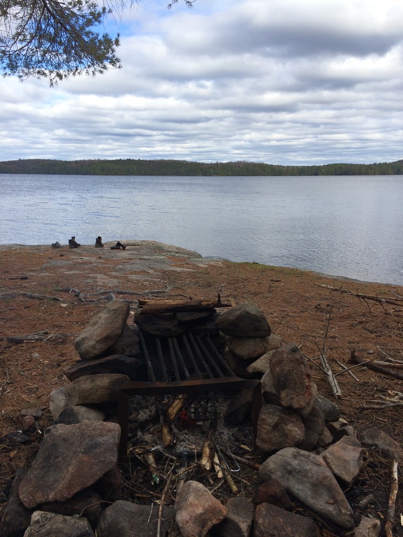
Early Spring view from a campsite on McIntosh Lake, Algonquin Provincial Park
Those who are really observant might notice a pair of boots, a pair of what are actually dive boots, and a single running shoe. On this particular trip the logic was: dive boots for paddling and getting in and out of the boat, hiking boots for the portages, and running shoes to have something dry to wear on the campsite. This was the first and only time I tried the dive boots, and the last time hiking boots came on any paddling trip. But that's not the story, the story is the single running shoe. Where is the other one?
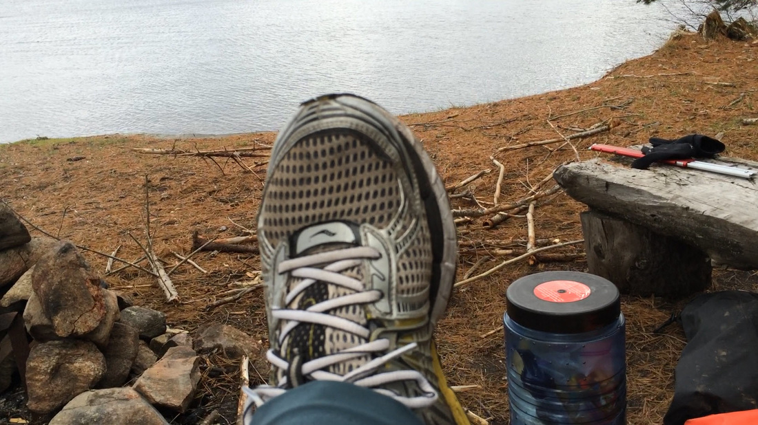
My hiking boots got thoroughly soaked on the Thompson - Ink portage: the trail was flooded in spots. So when I got to the campsite, one of the first things I did was to put on dry socks and my running shoes. Never underestimate the power of warm, dry feet. I then proceeded to go firewood hunting, and managed to step into a nice big water hole with my left foot. This was Day 1, and I was down to three dry socks (of six) and one dry shoe. I hadn't really seen the sun all day, so I held little hope any of it was going to dry out any time soon.
I went to bed long before the sun did, and slept soundly until dawn.
I went to bed long before the sun did, and slept soundly until dawn.
Day 2: McIntosh to Shah
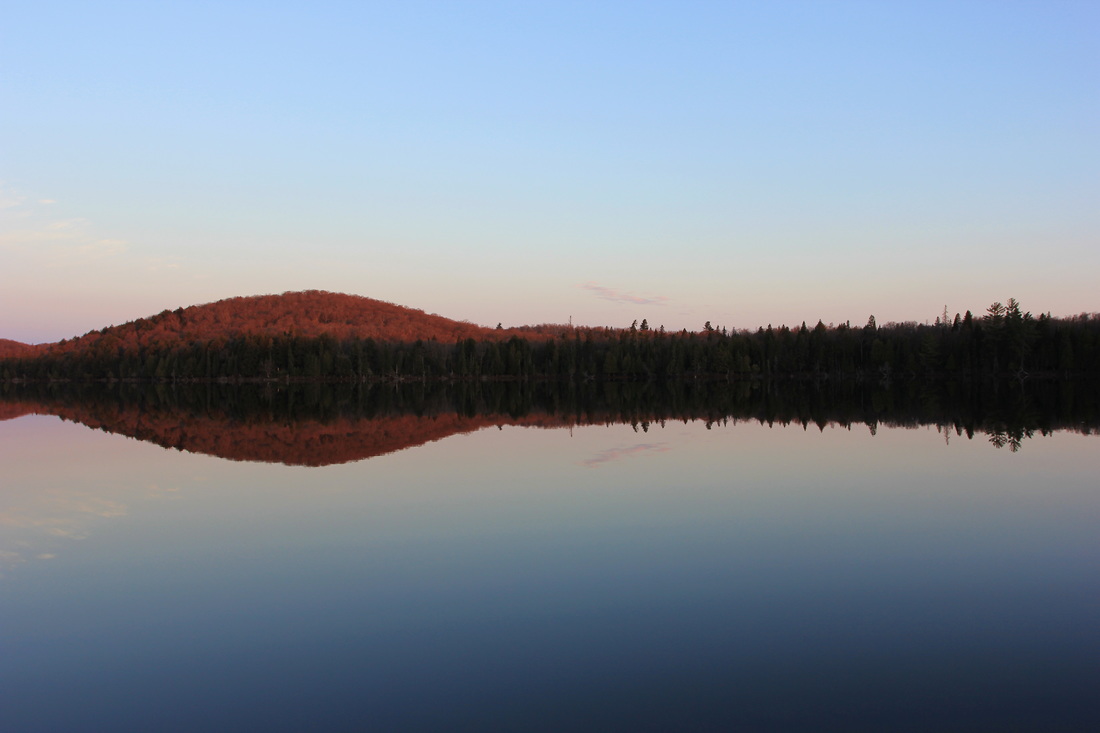
As I generally shoot for westward facing sites, it's not often I get to see sunrises in Algonquin so this morning was a special treat. The clouds and wind of the day before had given way to clear skies and calm waters - at least for the time being.

But based on the winds of the day before I had no faith the calm would last. Today was a fairly tame travel day, but I decided I'd rather get moving sooner rather than later. Not long after breakfast I packed up camp and pushed off from my campsite. The trip from McIntosh to Shah involves a portage into Timberwolf, a portage into Misty, and then two portages into Shah (with Pandion Pond between them).
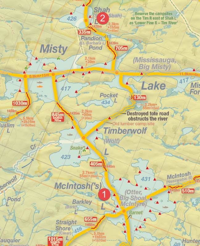
Map courtesy of Jeff's Maps - http://www.algonquinmap.com
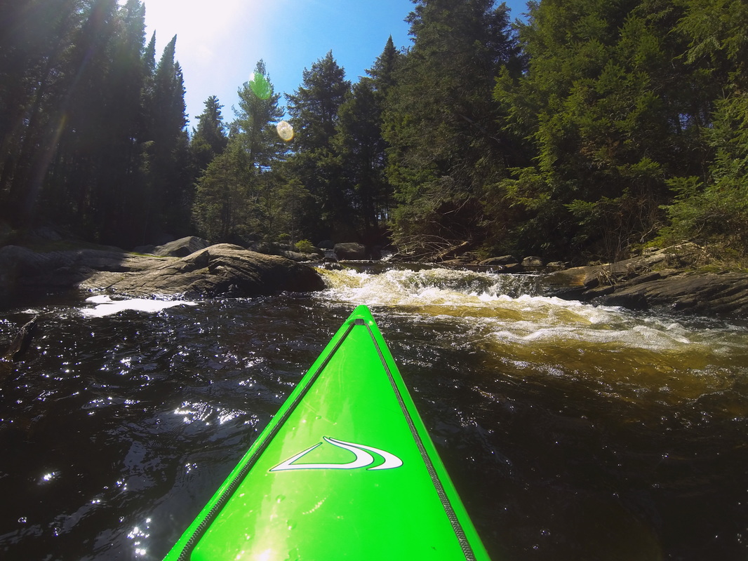
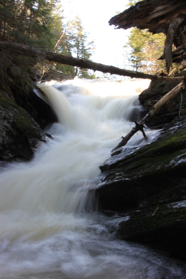
There are two options from Timberwolf into Misty: an 845m portage or a 130m portage. The 845 would make sense when Misty was the destination or I was portaging out of it to the west, but today there was only one smart choice: the 130. Even better, it meant some river travel and even a small waterfall along the portage! First I had to get there, of course. I was already most of the way across McIntosh, so it was a very short paddle to the first portage of the day: the 405 meter into Timberwolf. It was a beautiful morning and I'd barely used my camera, so I stopped at the beginning of this portage long enough to film a couple of the videos that are on my YouTube page: Packing a Canoe Pack, and Packing a Kayak.
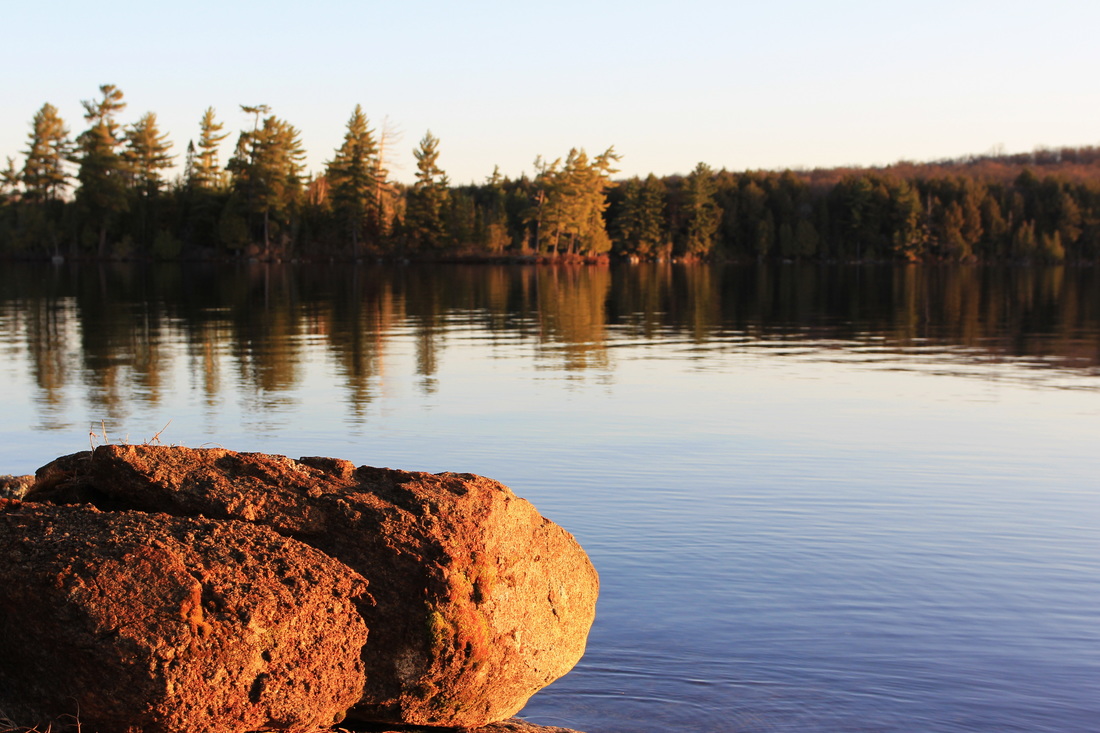
Timberwolf is one of my favourite lakes in Algonquin, and I always love to paddle it. I should add, however, that my list of favourite lakes is probably too long to make the word have much meaning. But it's a great lake! As I was coming up on one of my (ahem) favourite campsites, I could see it was occupied. I exchanged a few words with the guys on the site as I paddled by. The GoPro was on and taking pictures - it happened to catch the scene.
Timberwolf is one of my favourite lakes in Algonquin, and I always love to paddle it. I should add, however, that my list of favourite lakes is probably too long to make the word have much meaning. But it's a great lake! As I was coming up on one of my (ahem) favourite campsites, I could see it was occupied. I exchanged a few words with the guys on the site as I paddled by. The GoPro was on and taking pictures - it happened to catch the scene.
Saying Hi to Campers on Timberwolf Lake, Algonquin Provincial Park
Just around the corner from that campsite was the river, which was a relaxing and enjoyable paddle. Soon enough I pulled up to the short portage into Misty.
The 130m into Misty was a quick and easy downhill run. At the entrance to misty there was a tiny bit of rapids. I took a few pictures.
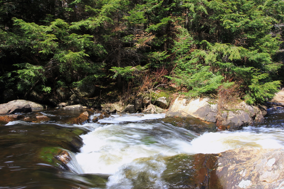
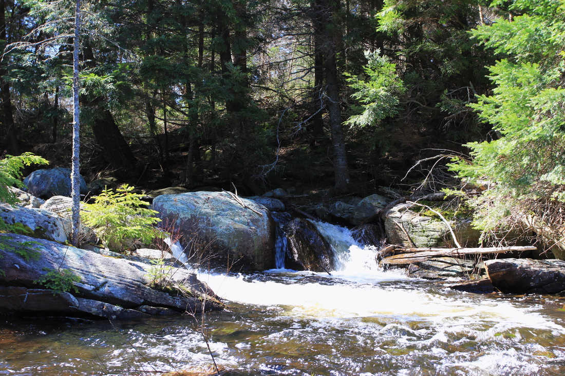
Thinking it might be more impressive in video format, I shot a few seconds' worth.
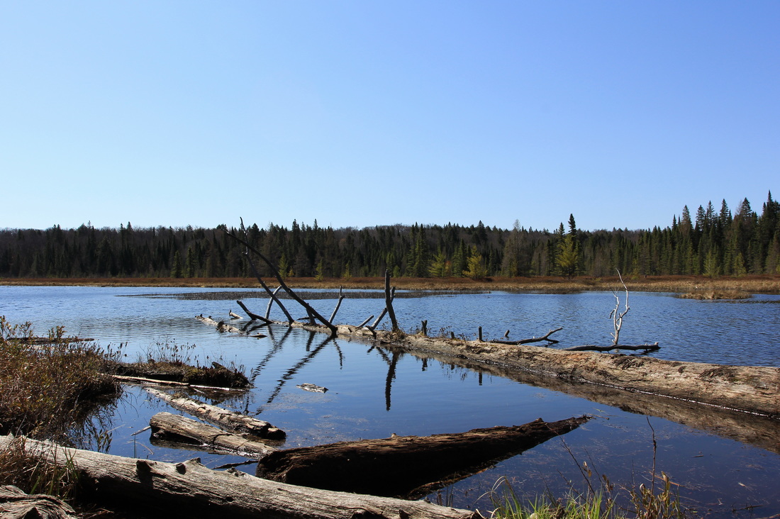
The paddle through the east end of Misty and the portages in and out of Pandion Pond were a dead spot in my photo and video log. Either I found nothing worth shooting, or the 'get-there-itis' that plagues many of my travel days had set hold. In either case, it wasn't until Shah that the camera made an appearance again.
Shah is not likely high on the 'must go there' list of most Algonquin campers, but I'd reached the point in my Algonquin adventures that I'd been there, done that. I had dozens of trips under my belt at access points all over the park. There was no longer the opportunity for exploring entirely new territory on any trip, so the focus had shifted to picking a lake I'd never been to, and going there. On this trip, Shah was that lake.
There was little doubt that I'd have the lake all to myself. A small and isolated body of water with only 4 campsites, mere days after ice-out, wasn't going to garner much traffic. The wind was really picking up at this point, but I had a conundrum: the nicest site on the lake also happened to be directly in the teeth of the wind. With a choice between windy vista and sheltered mediocrity, I took the windy vista. I pulled up, and set up. With no likelihood of rain in the forecast and plenty of time on my hands, I decided to repurpose my tarp into a wind break. The results were... interesting.
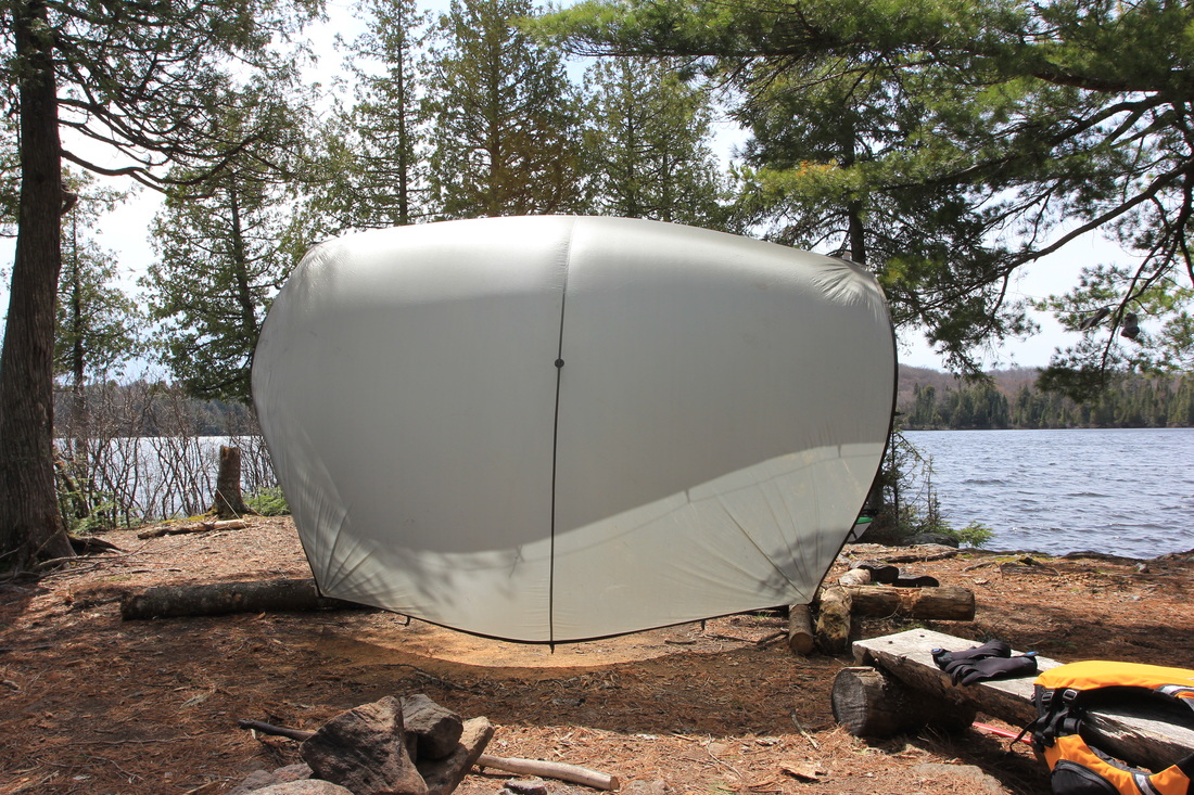
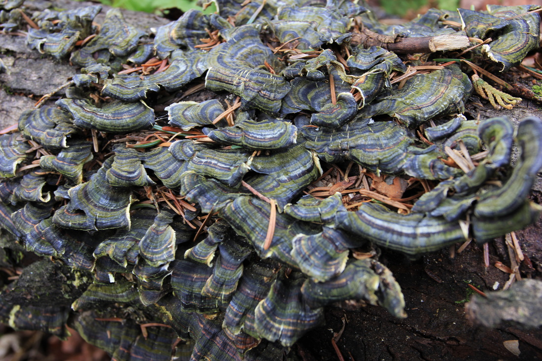
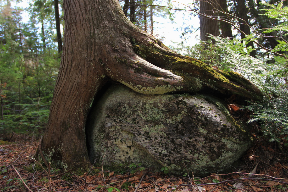
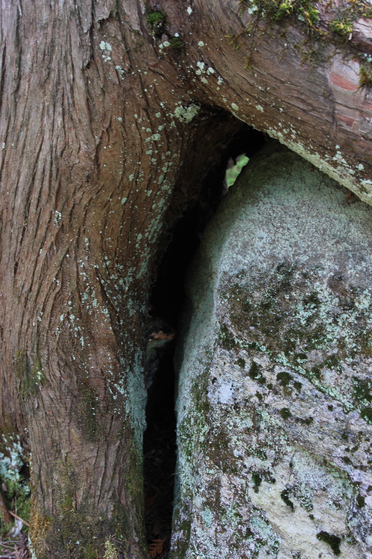
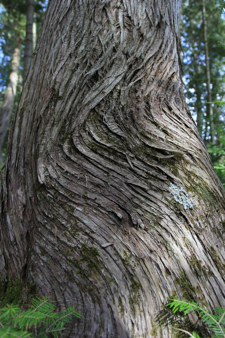
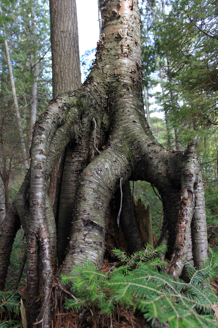
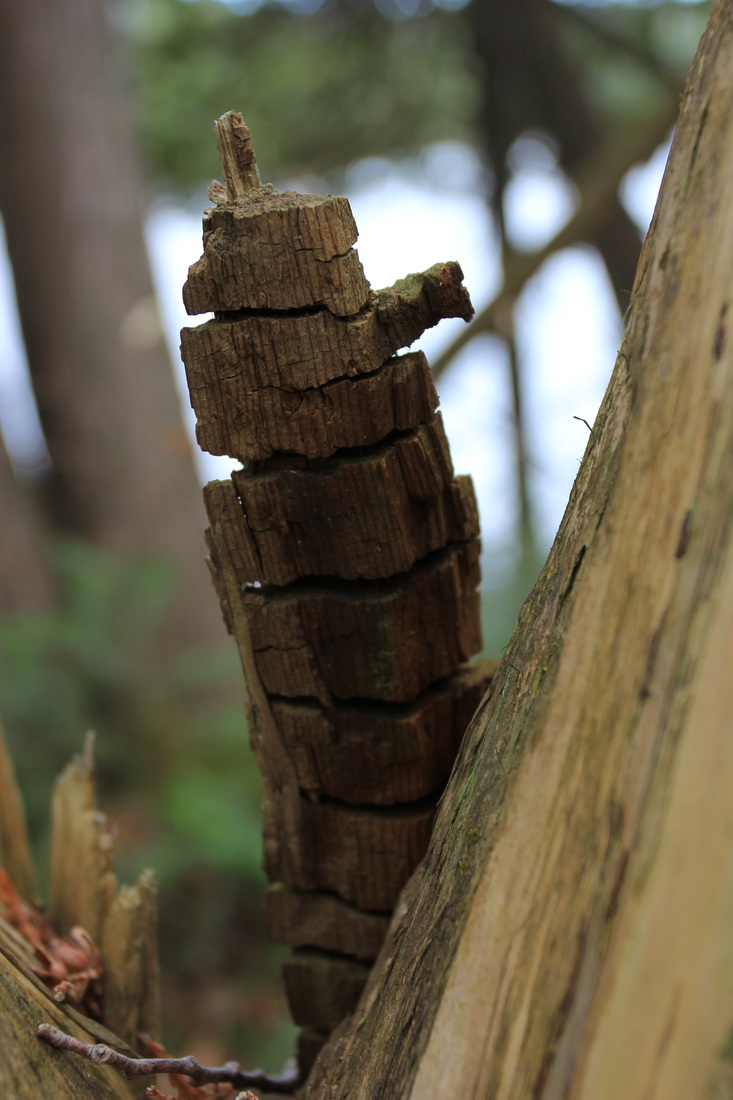
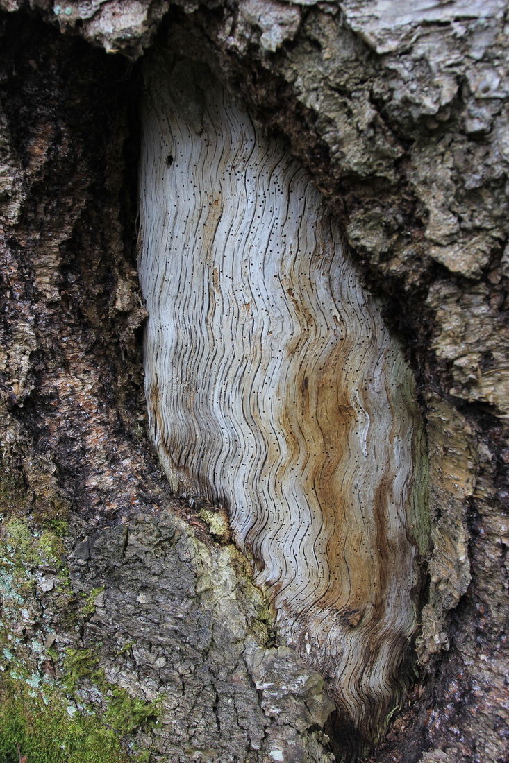
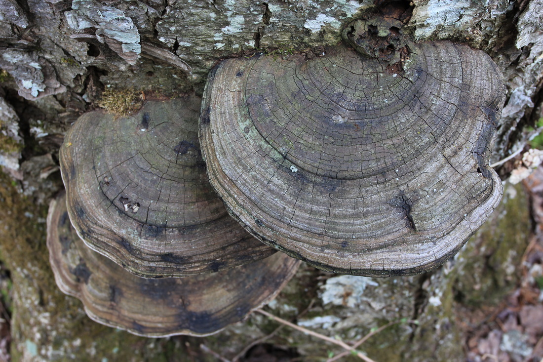
Despite looking like a sailboat's jib, it actually did a pretty good job of keeping the wind down. There were no bugs this early in the season, so the relief was appreciated. It was only mid-afternoon. The wind was strong enough to discourage me from exploring the lake, so I grabbed my camera and wandered around behind the campsite, taking pictures of anything I found interesting.


Photography, dinner, and maybe a few sips of rye passed the rest of the afternoon and evening in complete content. Camp clean, bear barrel stashed, I called it a night.
Day 3: Shah to Canoe
I'd taken two days getting here, but the plan was to return in one. I was a few pounds lighter and that would help, but I'd also found my portage legs. I was looking forward to the trip. But first I had to take advantage of a beautiful and calm morning to take a few pictures.

But I had a long day ahead of me, and I started the return trek in decent time. I stopped to take more, and better, pictures of the rapids at the edge of Misty.

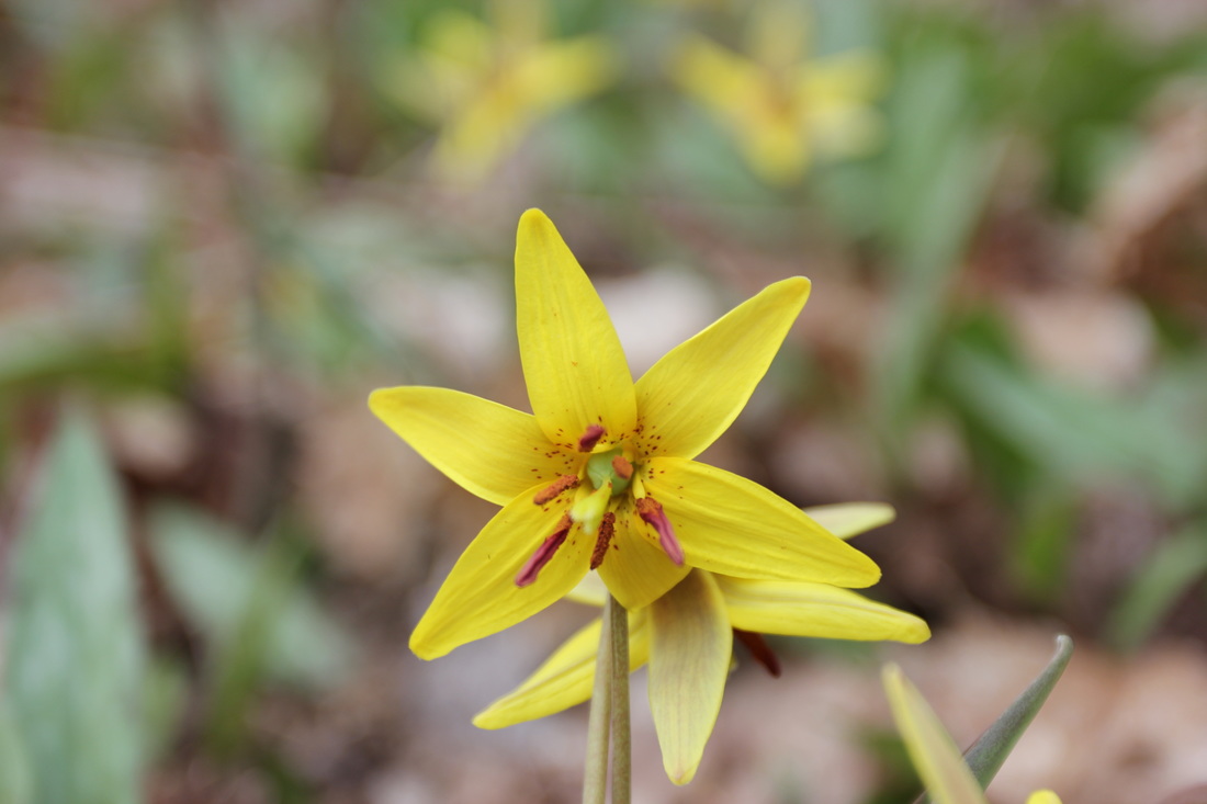
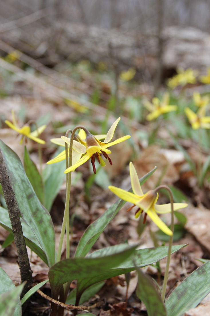
But I had many lakes, rivers and portages left to travel that day and a long drive home after that, so I pressed on. As always on long travel days, my camera has a hard time getting my attention. But I found some Spring flowers growing and couldn't resist.
The return portage from Ink to Tom Thomson was better, and worse, than when I walked it two days earlier. Better - gloriously better - because the portage had been cleared! Sawdust and freshly cut logs greeted me where fallen trees had been two days earlier. But worse because, while in the homestretch I managed to fall - hard. My kayak and my knee both managed to find their own rocks to land on. But it appeared to be no significant damage to either, and on I pressed. As I approached Tom Thomson it started to rain lightly, but that meant little next to the knowledge that the rest of my trip was paddling (the portage into Canoe didn't, and doesn't, count).
One last surprise was in store for me, however. As I paddled across Tom Thomson, I suddenly started feeling icy cold water brushing my legs at times, then continuing to rise higher until it reached my seat. The peace of a quiet paddle in the rain was interrupted by a less than manly screech. I realized there was a leak, but kept going as it obviously wasn't too bad. At the beaver dam (if you don't know the beaver dam, you should - it's practically an institution) I finally surveyed the damage: a 6 inch crack not far in front of my seat. The two sides of the crack had overlapped each other and that was allowing water in, so I simply pushed it back together, which held up for the rest of the paddle home.
A pull over the dam along with a pump and dump, and the rest of the return to the car went without a hitch. While I wasn't likely to make Shah a destination again any time soon, I was happy to have visited it. Any night in Algonquin is a great one. Any night when I have an entire lake to myself is even better.
For those who want to watch it, here's my journey from the end of the Ink Lake portage across part of Tom Thomson, with raindrops to keep me company.
