
My 2016 ice-out trip started later than I imagined. With an incredibly mild winter and half the ice thickness of the previous year, all of us Algonquin nuts were thinking we'd be camping in April. Then Spring turned out to be decidedly un-Spring like, and ice-out, and with it my plans, were pushed back. And back. And back. The first day you could go interior camping in Algonquin in 2016 was May 4th. My trip began on May 9th.
Day 1: Shall to Booth
Anyone who's ever been in through the Shall Lake access point knows that it's not actually on Shall Lake, but rather on a bit of a river connecting Farm and Crotch Lakes. So while my trip log says "Shall", I've never actually been on it, and as Shall leads out of Algonquin I'm not likely going to be on it any time soon (or ever). Monday, May 9th turned out to be a beautifully sunny, but also cold and windy day, with forecast highs of 12 degrees. I pulled into the permit office around 10 AM. There was a very friendly and helpful woman working the permit office that morning, who pointed out places I might likely encounter wildlife, and who warned me the portages in the direction of McKaskill hadn't yet been cleared, and wouldn't be before I was going through them. I wasn't terribly concerned about that, but it was good to have advance warning. Based on a 4-night booking for a solo camper, I was informed the park owed me 24 cents, and would I like that on my card or would I perhaps be willing to donate it? Feeling generous, I donated. Oddly that wasn't enough motivation to move up up the clearing of the McKaskill portage...
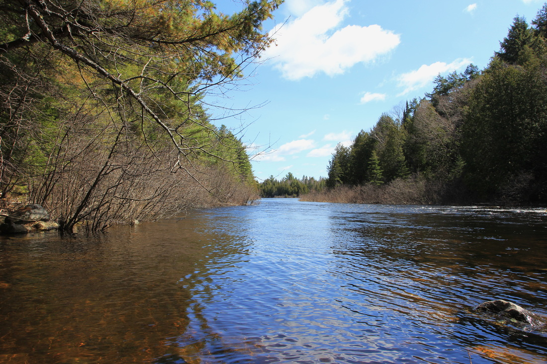
Permit in window, kayak off the roof and loaded up with my gear, I pushed off into the water, and was almost immediately battling a headwind. The combination of cold water and a cold breeze was enough to keep me mindful of just how dangerous the water temperatures were this time of year, and so I went out of my way to stick close to the shoreline while paddling across Farm Lake. At the far end of Farm Lake I encountered more people than I was to run in to for the rest of the trip combined, as three canoes worth of campers passed by me, heading back in the direction of the access point. We exchanged nods and hellos, and carried on our separate ways. The first portage up was marked as 90 meters, and with high water levels I had confidence I was likely going to be able to bypass it. As I approached it, I realized the challenge wasn't going to be the water level, but the water volume, as the rapids this portage bypassed were flowing fast. I decided to give it a shot and as luck would have it I was able to paddle my way through them, but I was definitely feeling the burn by the time I got out of the current.
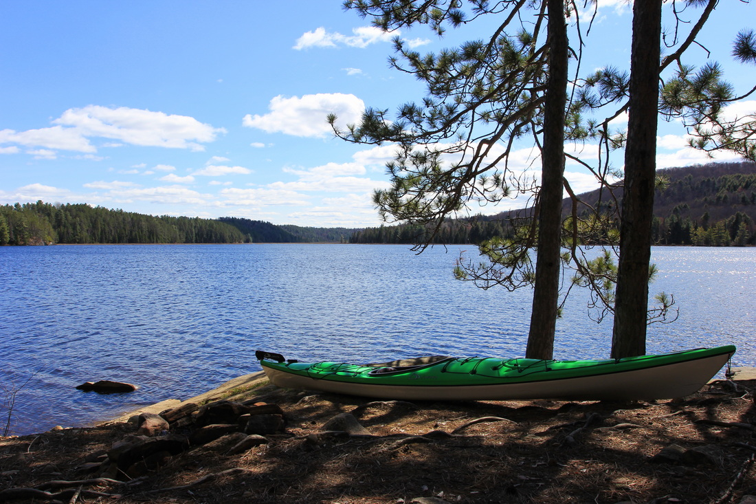
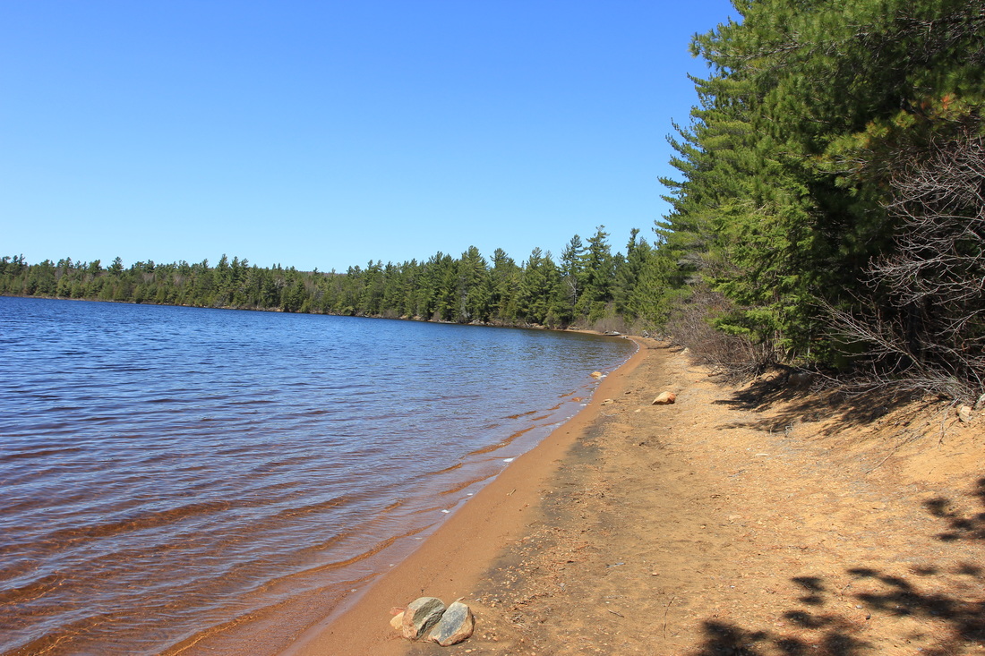
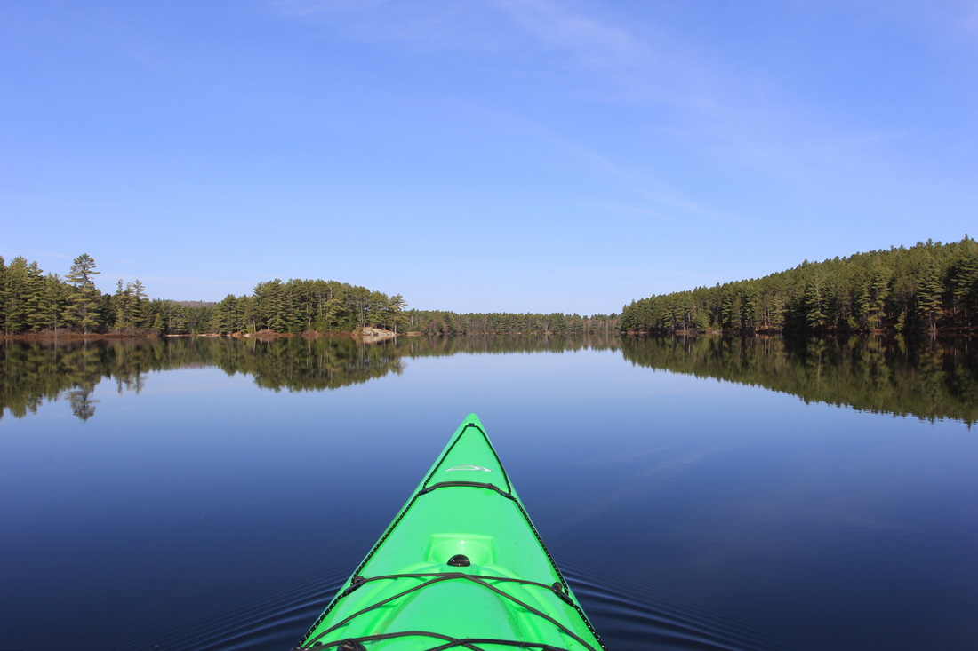
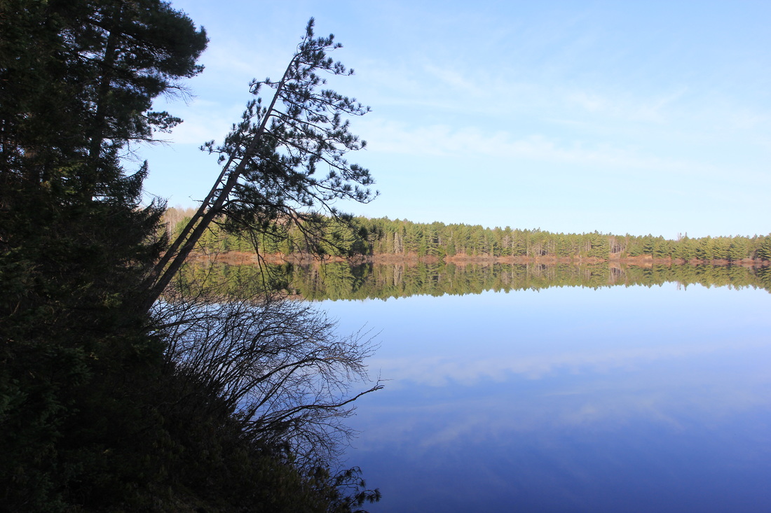
I had no such expectations of the 645 meter portage into Booth. If paddling ~50 meters worth of rapids had worn me out, I knew there was no chance I was going to battle upstream for half a kilometer. The paddle across Kitty was uneventful, and I pulled up to the start of the portage - my first of the year! Mindful of the fact that I had a history of not taking photos while travelling, and determined to be better about it, I pulled out my camera and snapped a picture looking back the way I came.
Permit in window, kayak off the roof and loaded up with my gear, I pushed off into the water, and was almost immediately battling a headwind. The combination of cold water and a cold breeze was enough to keep me mindful of just how dangerous the water temperatures were this time of year, and so I went out of my way to stick close to the shoreline while paddling across Farm Lake. At the far end of Farm Lake I encountered more people than I was to run in to for the rest of the trip combined, as three canoes worth of campers passed by me, heading back in the direction of the access point. We exchanged nods and hellos, and carried on our separate ways. The first portage up was marked as 90 meters, and with high water levels I had confidence I was likely going to be able to bypass it. As I approached it, I realized the challenge wasn't going to be the water level, but the water volume, as the rapids this portage bypassed were flowing fast. I decided to give it a shot and as luck would have it I was able to paddle my way through them, but I was definitely feeling the burn by the time I got out of the current.
I had no such expectations of the 645 meter portage into Booth. If paddling ~50 meters worth of rapids had worn me out, I knew there was no chance I was going to battle upstream for half a kilometer. The paddle across Kitty was uneventful, and I pulled up to the start of the portage - my first of the year! Mindful of the fact that I had a history of not taking photos while travelling, and determined to be better about it, I pulled out my camera and snapped a picture looking back the way I came.
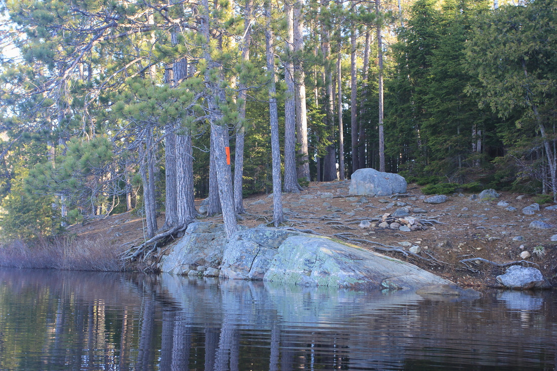
On the Kitty Lake side of the Kitty to Booth portage
In the weeks leading up to this trip, my left knee - the knee I'd had ACL reconstruction surgery on years earlier - had been giving me a lot of grief. There were days when I was limping, and when climbing the stairs was a hard thing to do. As I pulled up to this portage my knee was hurting quite a bit. I was very worried that this camping trip would be over before it began. If my knee wasn't up to carrying gear and a kayak, I'd either be heading home the same day or booking four nights on Crotch. Neither held much appeal, so I was hoping against hope that it would somehow be okay. As it turned out my knee was better than I could have hoped for, in that there was not a single twinge, not a single instance during the carry when it gave any indication of issues. I felt a huge sense of relief when I set down on the Booth Lake side of the portage.
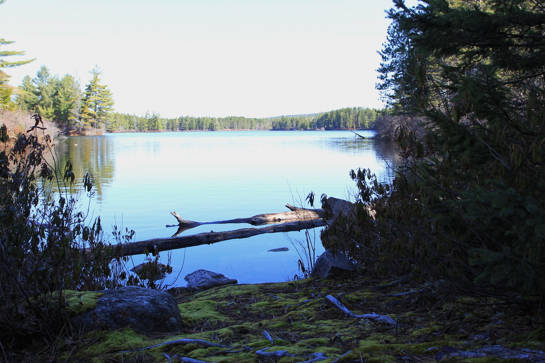
While Booth Lake boasts many beautiful "beachy" sites, I'm not a beach kind of guy. Give me a big chunk of Canadian shield any day, even if I have to scale it to set up a tent. That being said, I was quickly realizing that this part of the park was not the rugged, rocky, Canadian shield territory I loved so much. It was still beautiful, but exposed rocks were few and far between. Knowing that the cluster of sites along the east side of Booth were all 'beachy' sites, I decided I'd check out the island sites along the west side instead. I had a particular site in mind, on an island to itself. As the wind was still strong, however, I decided to stick to the South edge of Booth, paddling under another island with multiple campsites on it. This was the plan, basically - sticking close to land whenever possible, and checking out a few campsites along the way.
While Booth Lake boasts many beautiful "beachy" sites, I'm not a beach kind of guy. Give me a big chunk of Canadian shield any day, even if I have to scale it to set up a tent. That being said, I was quickly realizing that this part of the park was not the rugged, rocky, Canadian shield territory I loved so much. It was still beautiful, but exposed rocks were few and far between. Knowing that the cluster of sites along the east side of Booth were all 'beachy' sites, I decided I'd check out the island sites along the west side instead. I had a particular site in mind, on an island to itself. As the wind was still strong, however, I decided to stick to the South edge of Booth, paddling under another island with multiple campsites on it. This was the plan, basically - sticking close to land whenever possible, and checking out a few campsites along the way.
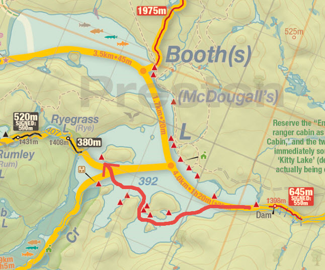
Map courtesy of Jeff's Map - www.algonquinmap.com
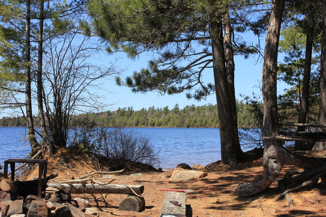
I have to say: some of those Southern island sites were quite nice! I was tempted to set up camp on a couple of them, but I wanted to at least check out the site I had originally planned on, so I carried on. The paddle underneath the island had been calm and out of the wind, but as I turned to the North again, the wind reminded me it was still there, waiting. I kept near land as much as possible but of course it's difficult to paddle to an island without ever leaving the shore, so I struck out at the closest distance to the island, paying extra care to my paddle strokes. As I reached the island and started rounding the west side of it, my goal came into view. Not only was it a great site, but it had some rock along the waterline! Not much mind you, but since I'd seen virtually none, it was almost like pulling up to Shangri-La.
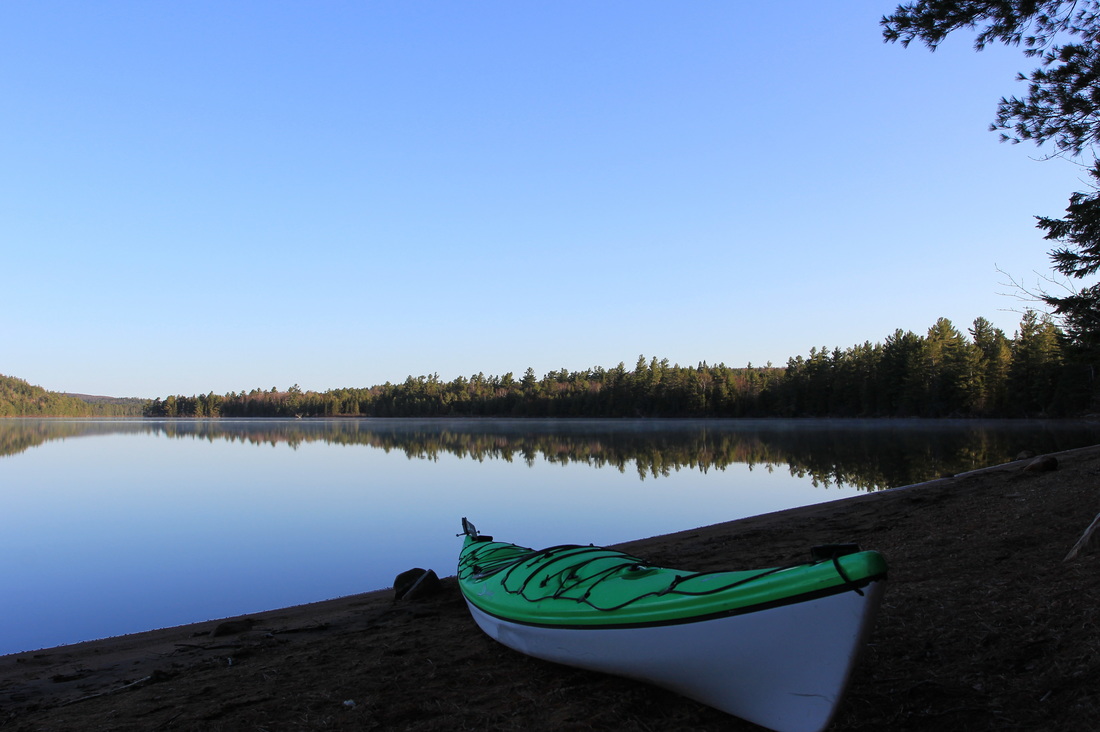
My campsite on Booth Lake. If you happen to have noticed the water is awfully calm for a super windy day, this is a picture from the next morning. You got me.
Elated with my decision to carry on to this site I pulled up, unpacked, and started getting organized. First thing first, I'd been wearing my spray skirt while paddling due to the windy, wavy conditions, but despite that I'd gotten a bit wet. My hiking pants were shortly hung up on a clothesline, and as they were the only pants I'd brought, I tossed on my shorts. It was most definitely not shorts weather. Realizing this flaw in my plans, I decided I'd be wearing shorts while travelling for the rest of the trip, saving the pants for my campsites. Shorts below, a t-shirt, a long sleeve, and a thicker long-sleeve above, I proceeded to set up camp, hunt up firewood for dinner, and take care of all of the other chores that are part of camping. Somewhere in there I managed to snap a few pictures. Some enterprising folks had rigged up a teeter-totter on this site, which, unless a bear were to come along and join me, I could only appreciate for its appearance, not its function.
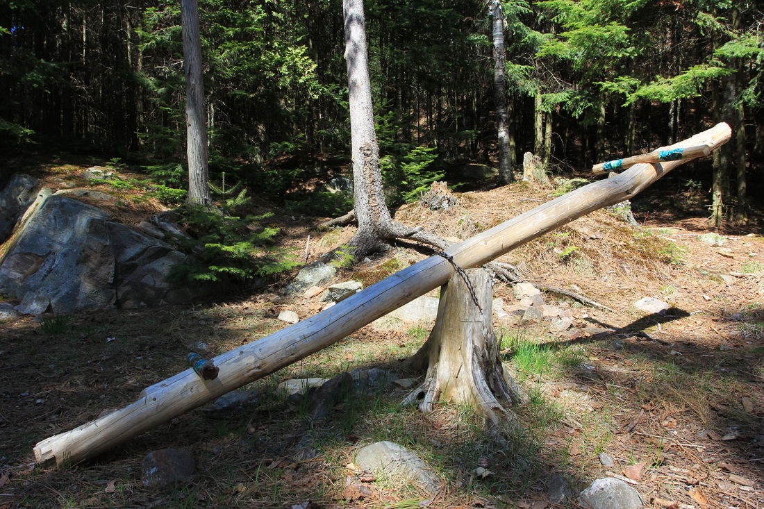
Booth Lake teeter-totter
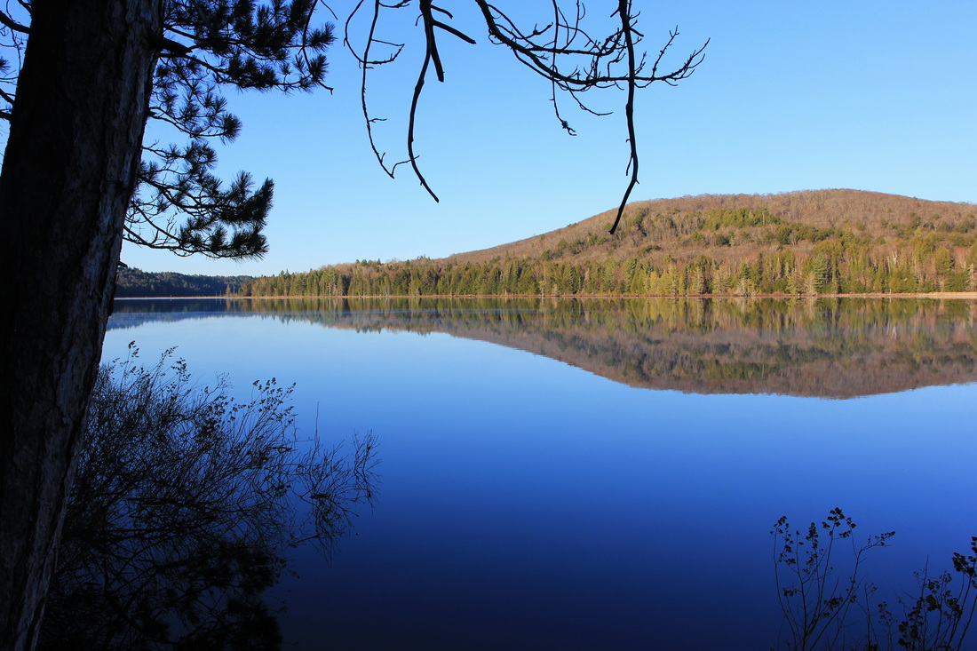
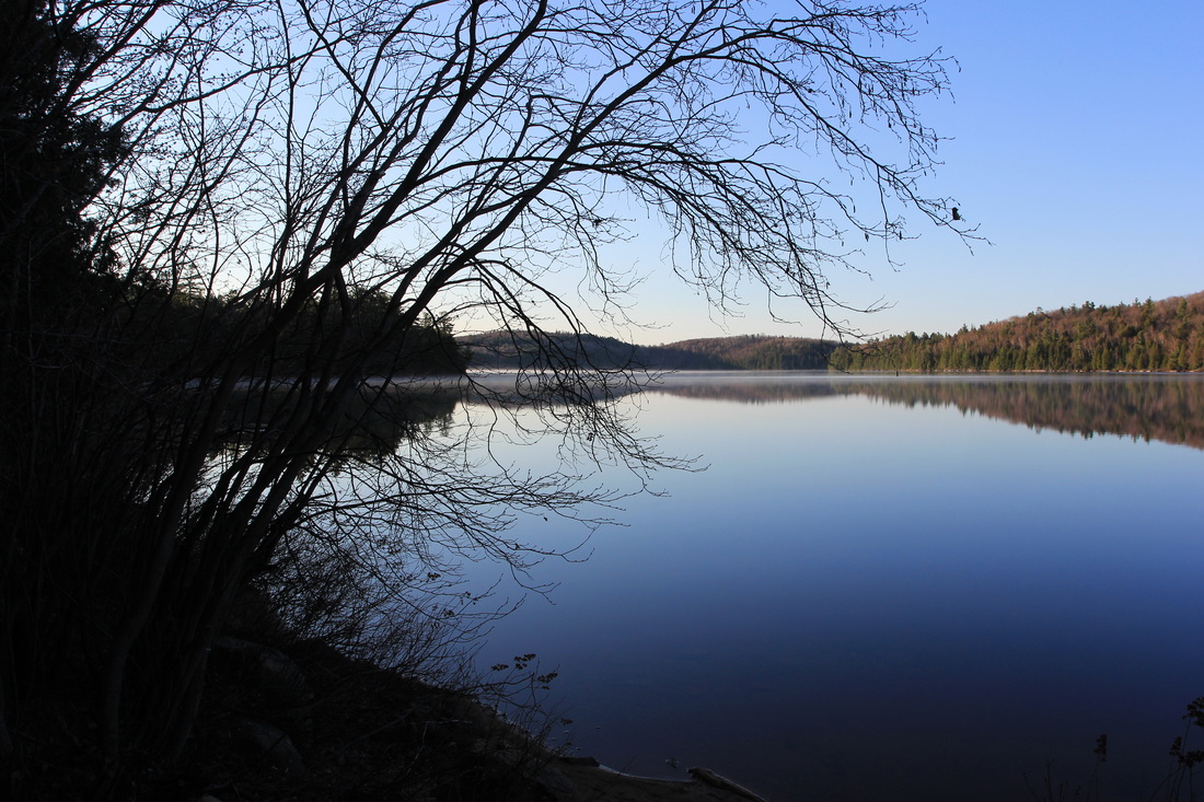
The view wasn't too shabby either.
View from my Island campsite on Booth Lake, Algonquin Provincial Park
It wasn't long before I realized how hungry I was getting, and as this was my first day in the park, it meant I had real food for dinner. In what has pretty much become a tradition by this point, my dinner was to be a couple of burgers with all the fixings. It wasn't long before they were sizzling on one of the grills I found by the fire pit.
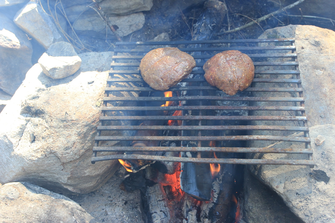
Burgers on the fire.
In what is also something of a tradition, although not an intentional one, I didn't last long beyond dinner. With the sun still at least an hour from setting I found myself crawling into my tent, vowing to read for as long as I... ZZzzzZzzzz.
Day 2: Booth to Shirley
My night on Booth's Lake had three notable occurrences.
First, as I had planned, I actually did get up in the middle of the night (thanks to an alarm) and try to take some night sky photographs. I was half awake and really cold, and so I didn't try for long. What pictures I did take were bad and out of focus - but I'll try again on another trip.
Second, as I was walking back up to my tent to go back to sleep on what had become a still and quiet night - SPLASH. A noise much like what it would sound like if a huge rock were dropped into the lake shattered the silence. I froze in place, more than a little freaked out. A pitch black, dead quiet night and something out there was most definitely awake and on the move. Seconds passed as I remained motionless, paying attention to the environment with every sense at my disposal. SPLASH, again, just as loud. Not knowing what to do or how to react I just kept standing there, feet from my tent, camera in hand. SPLASH, a third time, as loud as the others. Seconds bled into minutes and the sound didn't repeat a fourth time, and I finally convinced my legs it was okay to move again. I crawled back into my tent and double-checked I knew where my knife and my bear mace were located. Knowing sleep wasn't likely happening any time soon I pulled out my book, and read for the next hour or more. Finally, however, I drifted back off to sleep
Third, which is far less dramatic than number two, it was really cold. My sleeping bag was rated to -4 Celsius, but despite that and wearing every layer of clothing I had, it was an uncomfortable night. I was okay mind you, just not entirely comfortable. The night passed reasonably quickly nonetheless, but I don't think I got any quality sleep time in.
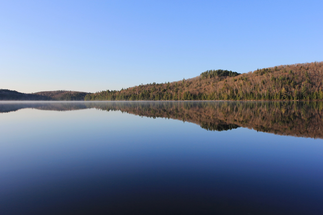
But the dawn did arrive, and eventually I talked myself into crawling out of my sleeping bag and facing the bracingly-cold morning air. The first thing I did after crawling out the tent was to get a fire going, which I rarely do in the morning. The second was to snap a few pictures, as the windy conditions of the day before had given away to a beautifully calm morning.
First, as I had planned, I actually did get up in the middle of the night (thanks to an alarm) and try to take some night sky photographs. I was half awake and really cold, and so I didn't try for long. What pictures I did take were bad and out of focus - but I'll try again on another trip.
Second, as I was walking back up to my tent to go back to sleep on what had become a still and quiet night - SPLASH. A noise much like what it would sound like if a huge rock were dropped into the lake shattered the silence. I froze in place, more than a little freaked out. A pitch black, dead quiet night and something out there was most definitely awake and on the move. Seconds passed as I remained motionless, paying attention to the environment with every sense at my disposal. SPLASH, again, just as loud. Not knowing what to do or how to react I just kept standing there, feet from my tent, camera in hand. SPLASH, a third time, as loud as the others. Seconds bled into minutes and the sound didn't repeat a fourth time, and I finally convinced my legs it was okay to move again. I crawled back into my tent and double-checked I knew where my knife and my bear mace were located. Knowing sleep wasn't likely happening any time soon I pulled out my book, and read for the next hour or more. Finally, however, I drifted back off to sleep
Third, which is far less dramatic than number two, it was really cold. My sleeping bag was rated to -4 Celsius, but despite that and wearing every layer of clothing I had, it was an uncomfortable night. I was okay mind you, just not entirely comfortable. The night passed reasonably quickly nonetheless, but I don't think I got any quality sleep time in.
But the dawn did arrive, and eventually I talked myself into crawling out of my sleeping bag and facing the bracingly-cold morning air. The first thing I did after crawling out the tent was to get a fire going, which I rarely do in the morning. The second was to snap a few pictures, as the windy conditions of the day before had given away to a beautifully calm morning.

My morning ritual proceeded as usual. Fetch the bear barrel. Boil water for oatmeal and coffee. Eat breakfast, drink coffee while sitting somewhere enjoying the view. Clean up from breakfast, brush teeth, then start taking down camp. While I didn't have a long day ahead of me, I rarely dawdle in the morning when I have somewhere to be. It was still early when I climbed into my kayak and pushed off gracefully... haha no, that's not what happened.
Okay so confession time: while I usually kayak a lot every year, 2015 was an exception. In April we got a puppy. In September our daughter was born. As a result of those two things, my 2015 camping season ended in July, and I didn't paddle a single day between that camping trip and when I launched into the water yesterday. Which is a long and poor excuse for what actually happened when I climbed into my kayak this morning. While I had my paddle in place across the back of the cockpit to use as a brace - here's a picture I grabbed off the internet to give you an idea of how it should work:
Okay so confession time: while I usually kayak a lot every year, 2015 was an exception. In April we got a puppy. In September our daughter was born. As a result of those two things, my 2015 camping season ended in July, and I didn't paddle a single day between that camping trip and when I launched into the water yesterday. Which is a long and poor excuse for what actually happened when I climbed into my kayak this morning. While I had my paddle in place across the back of the cockpit to use as a brace - here's a picture I grabbed off the internet to give you an idea of how it should work:
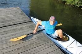
The notable thing in that picture is that he's keeping his weight to the entry side, using the paddle to keep the kayak secure and balanced.
What I did, was just plop my butt into the seat with no thought to balance or of keeping my weight over the paddle and to the side of land. As a result, as I sat down in the cockpit, my kayak immediately rolled on me. Not entirely, mind you - I was in shallow enough water that I managed to get my arm down and stop myself from dumping completely thanks to my hand that was now on a rock under two feet of water. But I was now tilted at a roughly 45 degree angle, my cockpit half filled with water, me soaked from the waist down. And I was stuck there. I was too far tilted to be able to simply push myself back level. If I were to remove my hand from the water bottom, I would immediately finish the roll and get dumped into freezing cold water. My only hope was a larger rock, a foot further beside me, that was sticking up out of the water. If I could just push myself off the bottom, and immediately grab onto that rock with the same hand, I could right myself and save the day! One, two, three... push! I pushed off, my kayak wobbled back towards center and I tried desperately to grab onto that rock, a beacon of hope in a sea of cold. But my hand slipped off and plunged back to the bottom where I once again caught myself from dumping entirely. I was now wetter, and my cockpit had even more water in it. But I literally had no other choice: it was try for the rock, or just let go and submerse myself entirely. On the second try I succeeded! I was soaking wet, my legs were going numb thanks to the foot and a half of water in my kayak, but I was back level! As I reached for the pump to start bailing out my boat, I started laughing like a maniac. Maybe you had to be there but trust me, it was funny.
After that experience, the rest of the day was less eventful. I retraced my path from the day before, as Shirley Lake is the other side of the access point. Back over the portage, then paddling the rapids (with the current this time), which made them decidedly less of a challenge. With last night's uncomfortable sleep in my mind, I had decided to make a quick pit-stop at the car, since I was paddling right past it anyway. A hoodie, in the car as part of my 'clean clothes to wear home' gear, was going to join me for the rest of the trip. As I approached the put-in, a couple was readying their canoe for their own excursion, so on the off chance they knew the forecast, I asked them. They assured me that the weather conditions, including the overnight temperatures, were going to be much nicer for the rest of the week. I decided that was good enough for me and carried on.
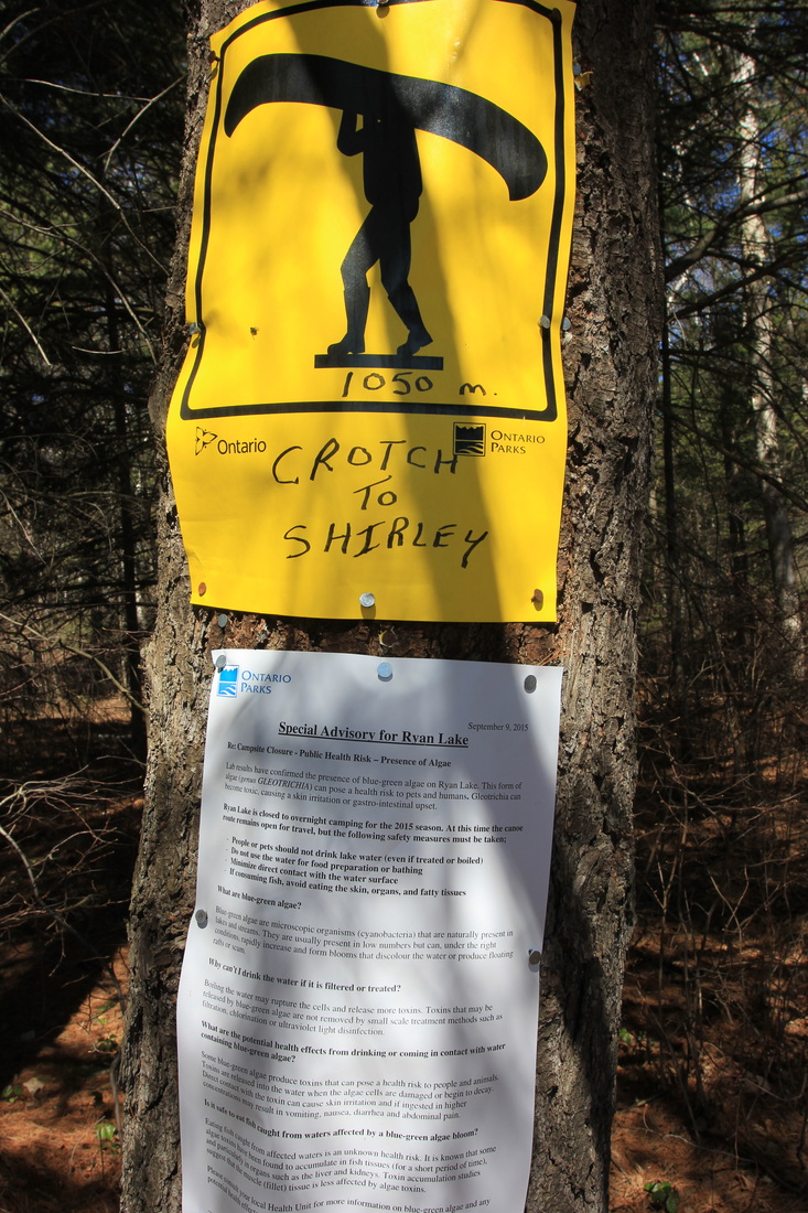
The paddle through Crotch Lake was nice, but soon over. I pulled up to the 1050 meter portage into Shirley. I noticed a large sign posted underneath the portage marker, which made me a bit nervous - when I'd seen those before, they were usually to warn about bear encounters. In this case, however, it was a notice from the previous year about blue-green algae on Ryan Lake.
What I did, was just plop my butt into the seat with no thought to balance or of keeping my weight over the paddle and to the side of land. As a result, as I sat down in the cockpit, my kayak immediately rolled on me. Not entirely, mind you - I was in shallow enough water that I managed to get my arm down and stop myself from dumping completely thanks to my hand that was now on a rock under two feet of water. But I was now tilted at a roughly 45 degree angle, my cockpit half filled with water, me soaked from the waist down. And I was stuck there. I was too far tilted to be able to simply push myself back level. If I were to remove my hand from the water bottom, I would immediately finish the roll and get dumped into freezing cold water. My only hope was a larger rock, a foot further beside me, that was sticking up out of the water. If I could just push myself off the bottom, and immediately grab onto that rock with the same hand, I could right myself and save the day! One, two, three... push! I pushed off, my kayak wobbled back towards center and I tried desperately to grab onto that rock, a beacon of hope in a sea of cold. But my hand slipped off and plunged back to the bottom where I once again caught myself from dumping entirely. I was now wetter, and my cockpit had even more water in it. But I literally had no other choice: it was try for the rock, or just let go and submerse myself entirely. On the second try I succeeded! I was soaking wet, my legs were going numb thanks to the foot and a half of water in my kayak, but I was back level! As I reached for the pump to start bailing out my boat, I started laughing like a maniac. Maybe you had to be there but trust me, it was funny.
After that experience, the rest of the day was less eventful. I retraced my path from the day before, as Shirley Lake is the other side of the access point. Back over the portage, then paddling the rapids (with the current this time), which made them decidedly less of a challenge. With last night's uncomfortable sleep in my mind, I had decided to make a quick pit-stop at the car, since I was paddling right past it anyway. A hoodie, in the car as part of my 'clean clothes to wear home' gear, was going to join me for the rest of the trip. As I approached the put-in, a couple was readying their canoe for their own excursion, so on the off chance they knew the forecast, I asked them. They assured me that the weather conditions, including the overnight temperatures, were going to be much nicer for the rest of the week. I decided that was good enough for me and carried on.
The paddle through Crotch Lake was nice, but soon over. I pulled up to the 1050 meter portage into Shirley. I noticed a large sign posted underneath the portage marker, which made me a bit nervous - when I'd seen those before, they were usually to warn about bear encounters. In this case, however, it was a notice from the previous year about blue-green algae on Ryan Lake.
After a quick couple of photos from this side of the portage,
I loaded up my pack and got ready to carry. Everything I'd read about this portage was that it was more or less like walking a road, and that turned out to be the case. Flat, wide, and good footing throughout, I was quickly at the other side, where I took a couple more pics.
I pushed off into the lake, fortunately more gracefully than my first attempt that day, and was underway. As with Booth, I had a pretty good idea of the site I wanted on Shirley, which involved paddling most of it enroute to a westward facing site north of the largest island. Trip reports I'd read had marked that as a big, beautiful campsite. However, the last time I'd checked online before leaving, there were two other parties on this lake other than me this night, so I was open to stopping elsewhere if a site caught my eye.
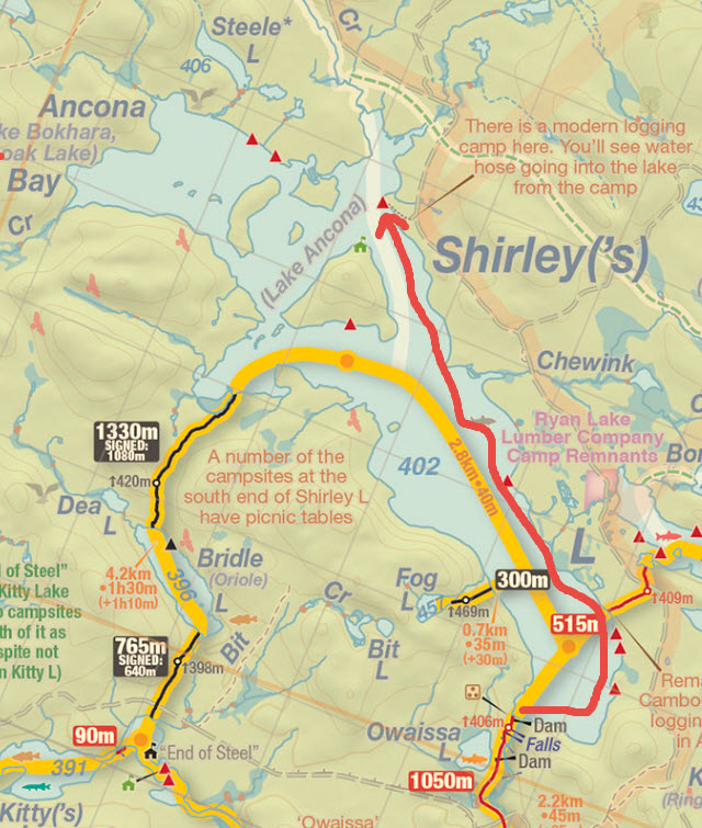
The tentative plan. Map courtesy of Jeff Maps - www.algonquinmap.com
I paddled straight east from the portage to check out the cluster of sites located there. The southermost of the three looked appealing from a distance, but as I drew a bit closer I realized there was movement, which quickly coalesced into people. I didn't bother looking closer at the site and headed more Northward to check out the other two. While both looked perfectly serviceable, neither were appealing enough to make me call it a day. Just North of the portage into Ryan there was another site, not marked on this version of Jeff's map, which was also 'okay', but not worth stopping for. I continued the paddle Northwest. The next campsite was quite a ways up the lake, and my tentative destination site was farther still. As I approached the next site I started to pay closer attention. On a point, it had a view of the lake for for almost 270 degrees. A sandy area to the south with a great view, The northeast side of the camp was one long beach. I've said it before and I'll say it again: I'm not a beach kind of guy, but Canadian shield didn't seem to exist in this part of the park, and this was a very pretty site. I decided to set up camp, because not only was this a beautiful site, but there was another group, as yet unaccounted for, elsewhere on the lake - at least in theory. I imagined paddling all the way up to my intended destination only to find it in use, and decided to stick with the bird in hand. I took a few photos of the site and the views.
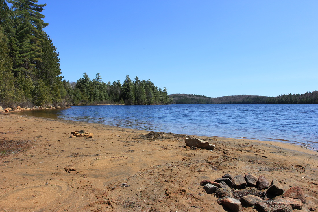

One thing I found very strange about Shirley Lake: it looks like it was built by someone using a large bulldozer. Most of the East side of the lake, at least, has a 'pushed up' bank, with lower lying land behind it again, as if you could drill through in a few spots and drain most of the lake out. As I set out to explore further, I realized those areas were often underwater as well of course, and had a few paddles through sections not part of the lake, but connected to it. I did, eventually, make my way up to the originally planned campsite. Of course it was empty, but I also wasn't that wowed by it. I didn't check out the two sites on Ancona Bay, but of the sites I did see I was convinced I had the best of them.
I kept my fire that night to just the burning of a twig stove to boil water. Dinner eaten, teeth brushed, bear barrel tossed into the woods, I once again failed to see the sunset. This night proved to be a bit less cold (but still less than comfortable), but I slept long and well, with nothing "notable" to report.
I kept my fire that night to just the burning of a twig stove to boil water. Dinner eaten, teeth brushed, bear barrel tossed into the woods, I once again failed to see the sunset. This night proved to be a bit less cold (but still less than comfortable), but I slept long and well, with nothing "notable" to report.
Day 3: Shirley to McKaskill
The morning dawned much as the previous one had: cold and still. And as with the previous morning, I convinced my cold hands to hold the camera for a few minutes.
Photos taken, oatmeal and coffee were next on the list, which meant firing up the twig stove. I stopped carrying a fuel stove entirely in 2015, and I have no plans to change that plan (fire ban situations being the exception. Fuel stoves are allowed to be used in a fire ban, twig stoves are not).
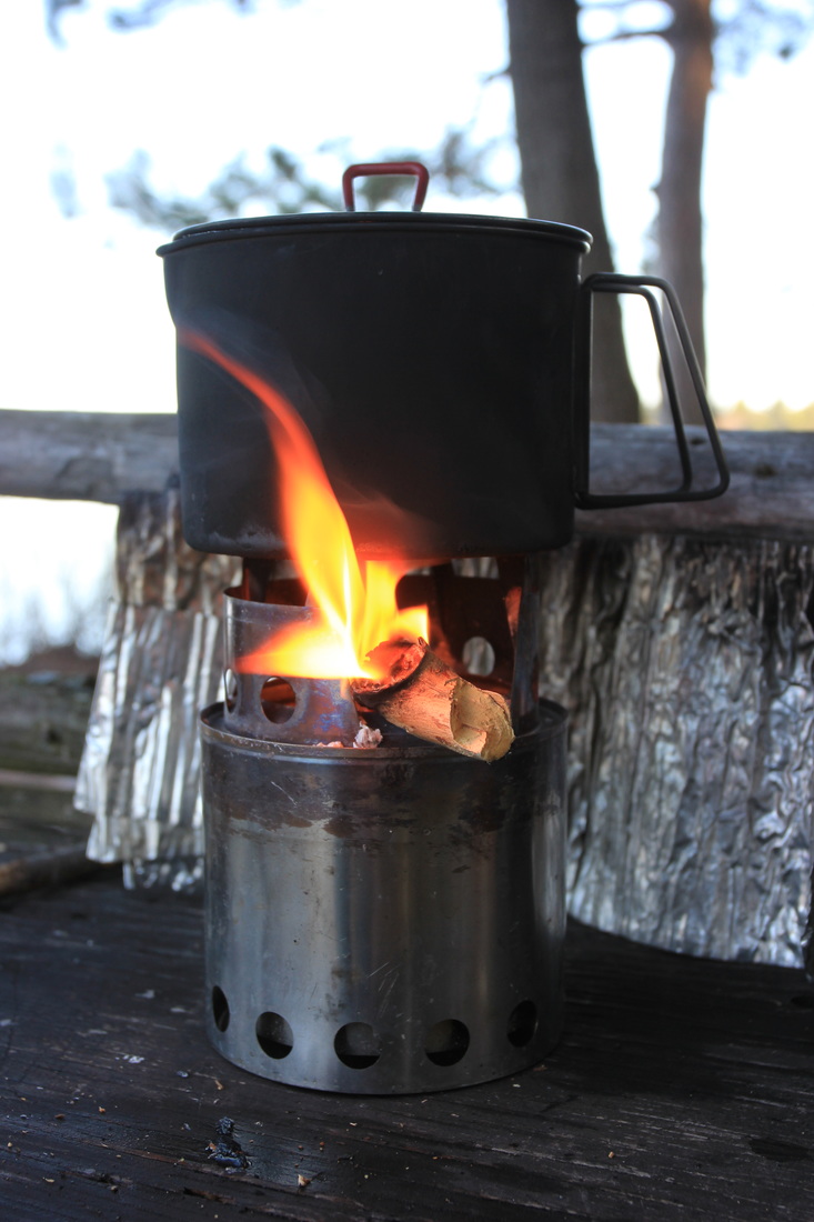
Boiling water for breakfast on Shirley Lake, Algonquin Provincial Park
As usual I had no plans to dawdle that morning, as McKaskill lake was calling. The trip to McKaskill was going to involve a great deal more portaging than paddling, and I'd been warned that most of them had not yet been cleared, so I wanted to get on my way. I packed up that morning leaving my saw out of its usual location (packed with the tent poles, wrapped in the tent - not exactly easy to get at in a pinch!) in case I needed it. I pushed off the site and began retracing my route back to the Ryan Lake portage I'd passed yesterday.
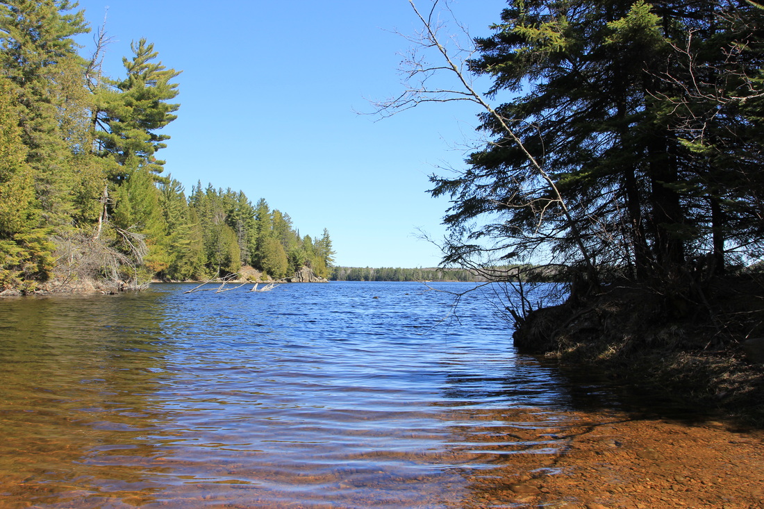
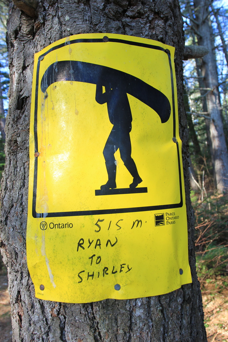
The portage from Shirley to Ryan was 515 meters of nothing - an easy trail that a car could have driven on. On the Ryan side of the portage I snapped a few photos, as the secluded bay the portage leads to was still and pretty in the morning light.
The portage from Shirley to Ryan was 515 meters of nothing - an easy trail that a car could have driven on. On the Ryan side of the portage I snapped a few photos, as the secluded bay the portage leads to was still and pretty in the morning light.

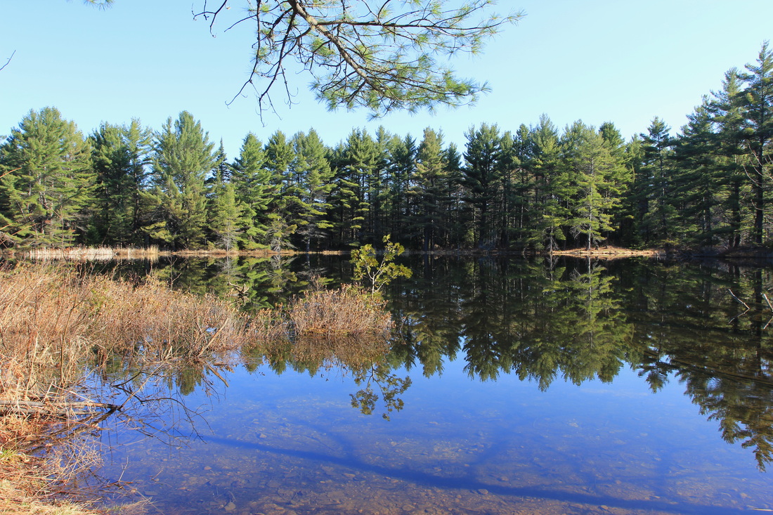
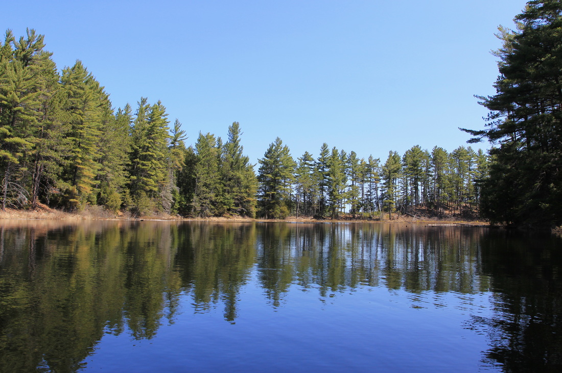
Ryan Lake as a whole was really pretty I found - maybe that explains why there are so many campsites on such a tiny lake. I pulled the camera out for another picture shortly after I hopped in the kayak.
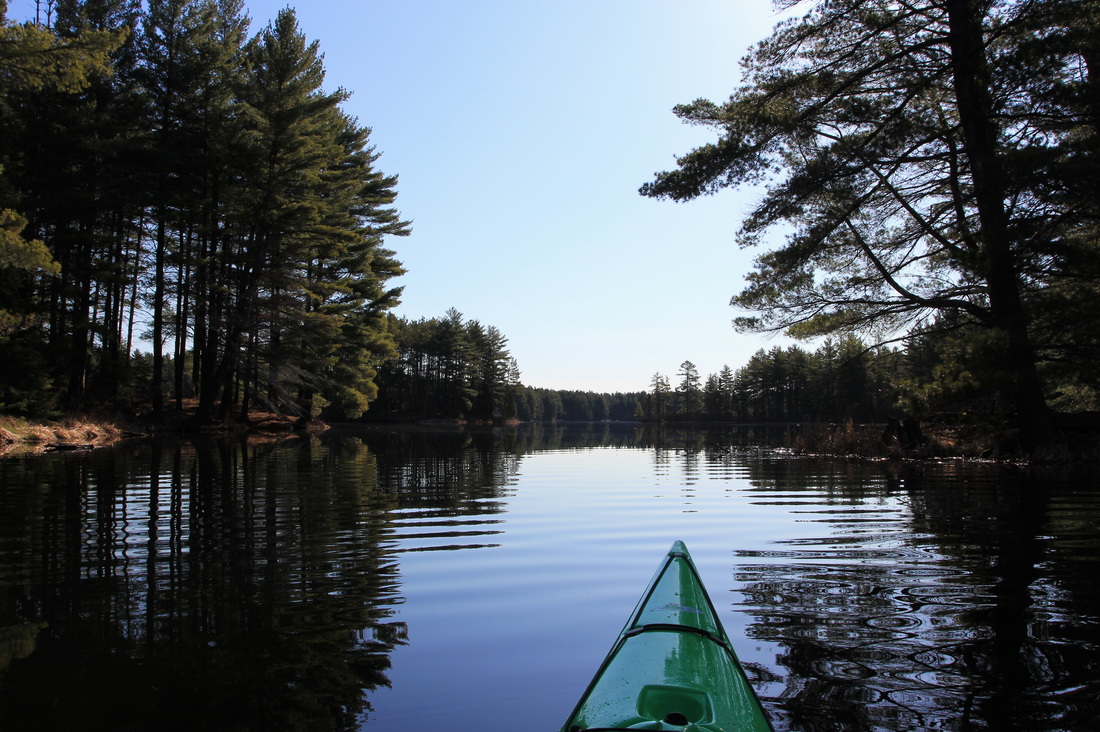
On the water on Ryan Lake, Algonquin Provincial Park
Ryan, however, was only the beginning of my travel day, and so I carried on. The 230 meter from Ryan into Big Red held no surprises. Big Red itself, however, did. A dot of a lake with no campsites, I noticed a patch of white along the shoreline on the other side. At first I thought there might still be some snow lining the water's edge (I'd already seen snow multiple times in the bush, it wasn't an impossible deduction), but then I realized it was the hull of a canoe. Having seen no-one that day, and it being such a tiny lake, it was inevitable we were going to paddle towards each other and share a few words. What wasn't inevitable, however, were the first words spoken to me:
"Hey, are you Bob?".
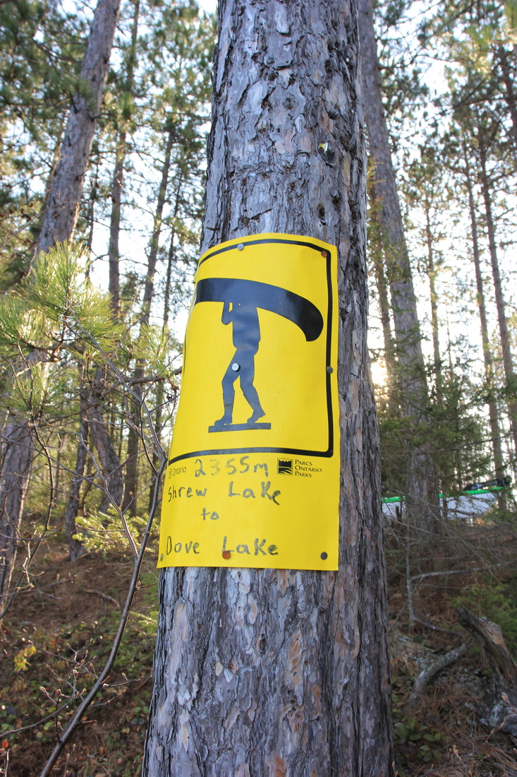
So on a nothing lake at a time of the year when virtually no-one is around, I just happened to bump into another Algonquin Adventures Forum regular - Martin. He recognized me because of the kayak, and he even picked it out as a Delta! We chatted for quite a few minutes. He was in the midst of a long loop starting and ending at Opeongo. He'd come down via Dickson, Animoosh and McKaskill and had spent the previous night on Shrew. Apparently he ran into a lot of snow on the portages between Dickson and McKaskill, but he reassured me that the 2420 meter into McKaskill (technically into Dove) had no big issues with snow or deadfalls. Eventually we pushed off and pushed on, Martin headed to Booth, and me to McKaskill. It was great to run into someone I "know" in the midst of nowhere like that.
Big Red into Shrew was another reasonably trivial portage. I found in general that there were far fewer roots and rocks on all my portages this trip than I was used to. While no-one loves climbing hills, it's nice to have good footing while you're doing it. I took a single picture of Shrew before paddling into it.
"Hey, are you Bob?".
So on a nothing lake at a time of the year when virtually no-one is around, I just happened to bump into another Algonquin Adventures Forum regular - Martin. He recognized me because of the kayak, and he even picked it out as a Delta! We chatted for quite a few minutes. He was in the midst of a long loop starting and ending at Opeongo. He'd come down via Dickson, Animoosh and McKaskill and had spent the previous night on Shrew. Apparently he ran into a lot of snow on the portages between Dickson and McKaskill, but he reassured me that the 2420 meter into McKaskill (technically into Dove) had no big issues with snow or deadfalls. Eventually we pushed off and pushed on, Martin headed to Booth, and me to McKaskill. It was great to run into someone I "know" in the midst of nowhere like that.
Big Red into Shrew was another reasonably trivial portage. I found in general that there were far fewer roots and rocks on all my portages this trip than I was used to. While no-one loves climbing hills, it's nice to have good footing while you're doing it. I took a single picture of Shrew before paddling into it.
View of Shrew Lake from the Big Red portage, Algonquin Provincial Park
The paddle across Shrew should have been a short one, but for some reason I failed to follow the map and ended up paddling up to, and past, the lone campsite instead of being where I was supposed to be. Realizing my mistake, I soon enough pulled up to the longest portage of the day, and of the trip - the 2420 meter from Shrew into Dove. To add insult to injury, the take out at Shrew was a steep slope with no place to get organized. Fortunately it levelled out pretty quickly, and so I dragged my fully loaded kayak up the ~10 meters to the flatter section above it. Here I took my first real break of the day. I had some snacks. I sent a SPOT "Okay" message home. I took a few photos and filmed a video.

View of Shrew Lake from the Dove Lake portage, Algonquin Provincial Park
And I noticed this sitting against a tree, where nobody who had been this way could have missed it:
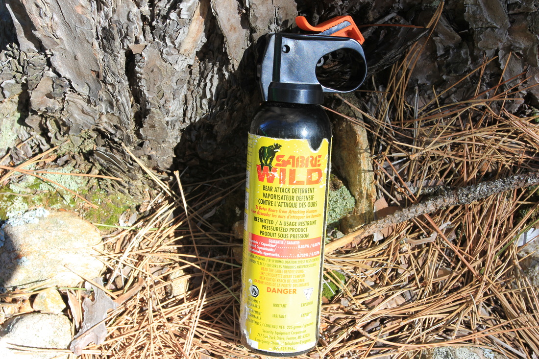
My first thought was: it must be Martin's. He's probably the only person who's been through this portage this year, and it doesn't look like it spent the winter here. But then on the other hand he made no mention of having lost his bear spray, and he spent last night on Shrew so either it wasn't his, he didn't know it was missing, or he didn't care it was missing. Speaking personally, my bear mace is one of my security blankets, and I would not be pleased to discover it missing.
My second thought was that I should take it with me. But on the off chance it was someone's, and that someone came looking for it, it wouldn't be kind of me to remove it.
My third thought was finally the correct one: I'm coming back this way. So, no need to do anything right now. I'll leave it, and if it's still sitting here on my way out, then I'll add it to my pack and trek it out. And that's what I did. I packed up and began the long portage, waving goodbye to the bear mace.
It turned out that Martin was correct (not that I doubted him). The portage had a few minor blowdowns but nothing that couldn't be stepped over, although I'll admit one particular coniferous blowdown had me about 30 feet in the wrong direction before I realized I was off the path. Going the wrong way is easy. Figuring out how to turn a 16 foot kayak around in the middle of a forest is somewhat harder, but I managed.
I was feeling like it was time for a break, and the opportunity presented itself: snow! On the portage! While I'd seen some in the bushes, I was actually going to walk on some, in May, in my water shoes. Okay so maybe it was a flimsy excuse but my shoulders were sore. So here's the picture/excuse. The picuse. The excture.
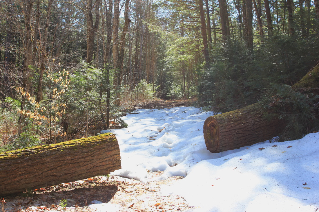
Snow on the portage between Shrew and Dove, May 11th, 2016, Algonquin Provincial Park
There were only the one set of footprints, so it looked like Martin had blazed the trail and I was backtracking. This wasn't the only patch of snow, or the deepest, but there was really nothing of consequence. If it's not gone already (three days later as I'm writing this) it will be very soon. Soon - surprisingly soon - I reached the end of the portage. I actually said out loud "That's it?" as I saw water approaching, not believing I'd already walked two and a half kilometers. But it was indeed the end, and I took a picture of the dot of a body of water known as Dove Lake.
At the end of the 2420 meter portage into Dove Lake, Algonquin Provincial Park
You probably can't see it at the resolution I posted that picture at, but the portage sign into McKaskill is in it, just left of center. The portage sign doesn't have any words on it, or distances, because it's too small to mention I suppose. Jeff's Map marks it as 40 meters, I'd call it closer to 20. Amazingly enough that tiny little portage had a deadfall across it. Normally that's no big deal, but there was no way in hell I was going to unload my kayak and load up a canoe pack when I could see the next lake from where I was standing. I intended to drag the kayak fully loaded. The last time I had that bright idea, it resulted in a punctured hull and gear floating in a dry hatch, but apparently I don't learn well from my mistakes. In any case, I was careful to drag the kayak err... more carefully? ... than that time. And while it wouldn't have been bright to try to drag a fully loaded kayak over a deadfall, as luck would have it, it fit underneath the tree trunk just fine. And with that, I was at my destination for the day - McKaskill!
Normally I'm pretty good at following maps in the park. I get where I'm going with very few mishaps or wasted time hunting for portages. But I have to confess, McKaskill turned me every which way but up. Campsites were coming into view where no campsite should be, and weren't coming into view where I thought they should be. McKaskill is not a huge lake, but I spent at least an hour paddling around it, genuinely perplexed about where I was at all times. At one point I realized that I was almost to the far North end of the lake and turned around, determined to spot the sites I'd clearly missed on the way up. Once again I failed to find sites where I thought they belonged, and then a site would pop up where it had no business being.
The plan was to check out the two westward facing sites in the middle of the lake, like so:
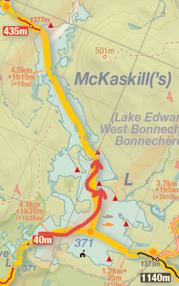
Map courtesy of Jeff Maps - www.algonquinmap.com
The reality was closer to this, however:
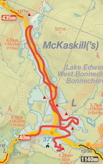
Map courtesy of Jeff Maps - www.algonquinmap.com
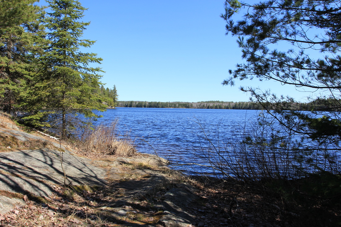
I'm still not entirely convinced that I ever saw the campsites I meant to stay on, but I did see quite a few sites (or maybe the same site multiple times) and none of them impressed me. Out of desperation, and thinking it might be the only site I could reliably find, I decided to check out the site nearest to the ranger cabin. And you know what? That turned out to be an absolutely beautiful campsite with great spots to set up tents and a fantastic view. If it weren't for my inability to read a map I might never have even seen this site, so I was suddenly happy for my tiring misadventure. I pulled up, unpacked and set up camp.
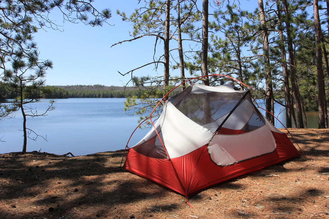
View from my campsite on McKaskill Lake, Algonquin Provincial Park
It was a glorious, warm, beautiful day and I enjoyed it to the fullest. I listened to music. I had a few sips of the rye I'd so diligently carried in for just such an occasion. I went for a swim. Okay so I actually waded out thigh deep in the water, dunked myself, soaped up, rinsed off, and ran back out as fast as possible. It was freezing cold and my legs were hurting by the time I got back to shore, but I really needed to clean up. And once I could feel my extremities again, I also realized it was refreshing. Plus going in the water on my ice-out trip is sort of a tradition. I guess technically I'd already accomplished that when half-dumping my kayak, but I'm not sure it counts when it's an accident.
I realized I was so lazily content that day because I'd had to put in some effort to get here. Short, easy travel days aren't for me, at least not when solo camping and out of swimming season. While the occasional lazy day on a longer trip might be a good thing, I knew I was happiest when on the move every day, even when I might be grumbling while doing so. And with that realization was the fact that I was supposed to spend tomorrow right there, on that lake. The lake I'd already paddled the length and breadth of, by accident, while looking for a campsite I never found. Couple that with my 7-month old daughter at home, and a wife thoughtful enough to let me go off camping for 5 days while she was left alone with said daughter (and a puppy and two cats), and I decided that tomorrow wasn't going to be a rest day, it was going to be Go Home day. I'd been to the lakes I wanted to visit on this trip, and spent a night on each of them. I'd explored, I'd portaged, I'd taken photos. It was time to go home to my baby, my wife, and my life.
That decided, I enjoyed the rest of the day even more, knowing it was my last opportunity on this trip to lie around and enjoy the sun, the air, the view, and the beauty of the park. Dinner came and went. I tentatively tried to crawl into my tent, once again long before sunset, but the beating sun on my tent fly quickly pushed me back out. It was the park's way of telling me that maybe I should see the sunset just once on this trip. Maybe.
The problem with clear skies is that it makes for boring sunsets, at least in my experience. Without clouds to refract the light, the sunset is just a darker picture. In any case, here's proof I managed to stay up at least as late as the average toddler, one night out of three:
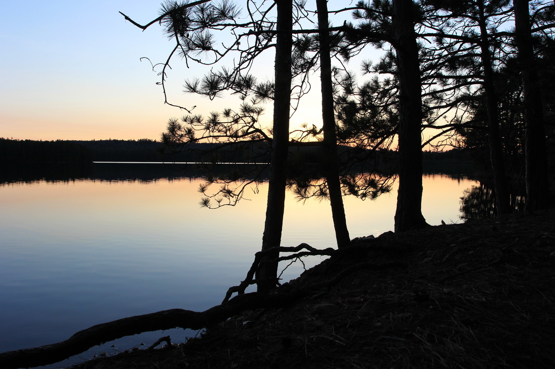
Sunset on McKaskill Lake, Algonquin Provincial Park
Needless to say I was asleep not long after that shot. I slept well and deeply.
Day 4: Bug-out day (aka McKaskill to the car)
I woke up early with one thing on my mind: get up and go. Or is that two things? In any case, the plan all along was to forgo unimportant things like a warm, filling breakfast and coffee in favour of eating a few frozen chunks of chocolate and washing them down with a shot of rye. The chocolate was on purpose. The rye happened when I was digging through my bear barrel and saw a sad, bent, mostly empty bottle of rye. I felt sorry for it, and had to comfort it. By drinking rye at what was probably 5 AM. In any case it warmed me when nothing else that morning was going to. I was on the water early, and while my 'get-there-itis' was still with me, I found it wasn't as strong as on previous trips. I stopped and relaxed a few times while retracing my steps. I took pictures. I even filmed a video or two. But a return trip is still a return trip, and talking about lakes I've already talked about and portages I've already walked isn't terribly interesting.
Here's a few pictures I took on the way back to the car. The nicest ones are again from Ryan Lake somehow. That really is a very cute little lake, although I imagine it's the farthest thing from peaceful when camping season begins in earnest. The bear mace was still there by the way, and I carted it out as promised. Martin: if it's yours I'm happy to return it to you, but the expiry date is Jan 2015, so it might be time for a new one!
Here's a few pictures I took on the way back to the car. The nicest ones are again from Ryan Lake somehow. That really is a very cute little lake, although I imagine it's the farthest thing from peaceful when camping season begins in earnest. The bear mace was still there by the way, and I carted it out as promised. Martin: if it's yours I'm happy to return it to you, but the expiry date is Jan 2015, so it might be time for a new one!

I'll leave this trip report by saying: it was a wonderful, relaxing, peaceful trip. Ice-out trips are almost my favourite time of year to go camping. Few people, no bugs, peace, quiet, solitude. If the water was warm enough to swim in I'd call it my favourite time of year, but as I love swimming, that award has to go to mid-late September. While my next trip of 2016 isn't yet planned, I can guarantee you there will be an ice-out, 2017 camping trip.
